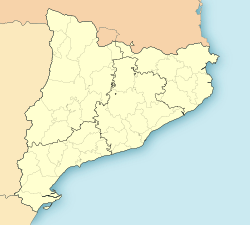
Camarles
Appearance
Camarles | |
|---|---|
 Camarles parish church | |
| Coordinates: 40°46′25″N 0°40′21″E / 40.77361°N 0.67250°E | |
| Country | |
| Community | |
| Province | Tarragona |
| Comarca | Baix Ebre |
| Government | |
| • Mayor | Josep Antoni Navarro Serra (2019)[1] |
| Area | |
• Total | 25.2 km2 (9.7 sq mi) |
| Elevation | 13 m (43 ft) |
| Population (2018)[3] | |
• Total | 3,278 |
| • Density | 130/km2 (340/sq mi) |
| Demonym(s) | Camarlenc, camarlenca |
| Website | camarles |
Camarles (Catalan pronunciation: [kaˈmaɾles]) is a municipality in the comarca of the Baix Ebre in Catalonia, Spain. It was created in 1978 from parts of the municipality of Tortosa. It is situated in the east of the comarca, near the head of the Ebre delta. The town is served by the N-340 road to Tortosa, which also connects it with the AP-7 autopista at either l'Aldea to the south or l'Ampolla to the north.
References
[edit]- ^ "Ajuntament de Camarles". Generalitat of Catalonia. Retrieved 2019-12-30.
- ^ "El municipi en xifres: Camarles". Statistical Institute of Catalonia. Retrieved 2015-11-23.
- ^ Municipal Register of Spain 2018. National Statistics Institute.
- Panareda Clopés, Josep Maria; Rios Calvet, Jaume; Rabella Vives, Josep Maria (1989). Guia de Catalunya, Barcelona: Caixa de Catalunya. ISBN 84-87135-01-3 (Spanish). ISBN 84-87135-02-1 (Catalan).
External links
[edit]- Official website (in Catalan)
- Government data pages (in Catalan)


