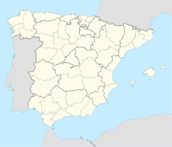
Cea, León
Appearance
You can help expand this article with text translated from the corresponding article in Spanish. Click [show] for important translation instructions.
|
Cea | |
|---|---|
 | |
| Coordinates: 42°27′45″N 5°0′46″W / 42.46250°N 5.01278°W | |
| Country | Spain |
| Autonomous community | Castile and León |
| Province | León |
| Municipality | Cea |
| Government | |
| • Mayor | Ángeles García Rodríguez (PP) |
| Area | |
• Total | 112.34 km2 (43.37 sq mi) |
| Elevation | 836 m (2,743 ft) |
| Population (2018)[1] | |
• Total | 426 |
| • Density | 3.8/km2 (9.8/sq mi) |
| Time zone | UTC+1 (CET) |
| • Summer (DST) | UTC+2 (CEST) |
| Postal Code | 24174 |
| Telephone prefix | 987 |
| Climate | Cfb |
| Website | Ayto. de Cea |
Cea (Spanish pronunciation: [ˈθea], rarely Ceia) is a municipality located in the province of León, Castile and León, Spain. According to the 2010 census (INE), the municipality has a population of 530 inhabitants.
Historically, there was a Sephardic Jewish community in Cea, first recorded in 1110. Most of the Jews maintained professions in agriculture. In 1492, the community fled during the expulsion of the Jews from Spain.[2] Cea is mentioned in the 10th century text Nodicia de kesos.
Villages
[edit]See also
[edit]References
[edit]- ^ Municipal Register of Spain 2018. National Statistics Institute.
- ^ "Jewish Virtual Library". Cea, Spain. Retrieved 28 June 2024.
External links
[edit]Wikimedia Commons has media related to Cea, León.
- La provincia de León y sus comarcas; Cea-Campos Archived 2017-08-21 at the Wayback Machine


