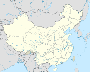
Chongru She Ethnic Township
Chongru
崇儒畲族乡 Ch'ung-ju | |
|---|---|
 | |
 | |
| Coordinates: 26°57′04″N 119°55′31″E / 26.95111°N 119.92528°E | |
| Elevation | 247 m (810 ft) |
| Population (2012-01-18) | 2,800 |
| [1] | |
| Time zone | |
| Asia/Shanghai | UTC+8 (CT) |
Chongru She Ethnic Township (崇儒畲族乡) is an ethnic township in Xiapu County.
Located in Fujian Sheng province, in the southeastern part of the country, 1,500 km south of Beijing is the capital of the country. 247 meters above sea level is located in Chongru, and has 2,800 inhabitants.[1]
The land around Chongru is hilly.[a] The highest point in the vicinity has an elevation of 562 meters and is 2.0 km west of Chongru.[b] There are about 214 people per square kilometer around Chongru relatively sparsely populated.[3] The nearest larger town is Songcheng, 10.7 km southeast of Chongru. The area around Chongru is almost covered with dust and barrenness.[4] In the region around Chongru, lakes are remarkably common.[c]
The climate is subtropical.[5] The average temperature is 18 °C. The warmest month is July, at 24 °C, and the coldest January, at 10 °C.[6] The average rainfall is 2,105 millimeters per year. The wettest month is August, with 322 millimeters of rain, and the wettest October, with 52 millimeters.[7]
| ||||||||||||||||||||||||||||||||||||||||||||||||||||||||||||||||||||||||||||||||||||||||||||||||||||||||||||||||||||||||||||
Notes
[edit]- ^ Calculated from the contention of all length data (DEM 3 ") from Viewfinder Panoramas, within a 10 kilometer radius. [2] The full algorithm is available here.
- ^ Calculated from length data (DEM 3 ") from Viewfinder Panoramas. [2] The full algorithm is available Lsjbot/Make-Geonames here.
- ^ More than 20 kilometers away compared to the average density of the Earth, according to GeoNames. [1]
References
[edit]- ^ a b c Chongru sa Geonames.org (cc-by); post updated 2012-01-18; database download sa 2017-02-07
- ^ a b "Viewfinder Panoramas Digital elevation Model". 2015-06-21.
- ^ "NASA Earth Observations: Population Density". NASA/SEDAC. Archived from the original on 9 February 2016. Retrieved 30 January 2016.
- ^ "NASA Earth Observations: Land Cover Classification". NASA/MODIS. Archived from the original on 28 February 2016. Retrieved 30 January 2016.
- ^ Peel, M C; Finlayson, B L. "Updated world map of the Köppen-Geiger climate classification". Hydrology and Earth System Sciences. 11: 1633–1644. doi:10.5194/hess-11-1633-2007. Retrieved 30 January 2016.
- ^ a b "NASA Earth Observations Data Set Index". NASA. Archived from the original on 28 November 2017. Retrieved 30 January 2016.
- ^ "NASA Earth Observations: Rainfall (1 month - TRMM)". NASA/Tropical Rainfall Monitoring Mission. Archived from the original on 11 May 2020. Retrieved 30 January 2016.

