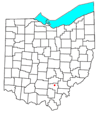
Creola, Ohio
Appearance

Creola is an unincorporated community in southern Swan Township, Vinton County, Ohio, United States.[1] It had a post office, with ZIP code 45622, from 1860 until May 15, 1992, when service was suspended and mail was instead routed through New Plymouth, Ohio.[2][3] It is located along State Route 93 approximately five miles north of the county seat of McArthur.

References
[edit]- ^ U.S. Geological Survey Geographic Names Information System: Creola, Ohio
- ^ "USPS - Postmasters by City". Archived from the original on August 30, 2010. Retrieved August 23, 2010.
- ^ History of Hocking Valley, Ohio. Inter-State Publishing Co. 1883. pp. 1307.
39°18′55″N 82°27′59″W / 39.31528°N 82.46639°W

