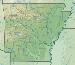
Dennard, Arkansas
Dennard, Arkansas | |
|---|---|
 Dennard Post Office | |
 Location of Dennard in Van Buren County, Arkansas. | |
| Coordinates: 35°46′02″N 92°31′45″W / 35.76722°N 92.52917°W | |
| Country | United States |
| State | Arkansas |
| County | Van Buren |
| Township | Washington |
| Area | |
• Total | 21.93 sq mi (56.80 km2) |
| • Land | 21.90 sq mi (56.72 km2) |
| • Water | 0.03 sq mi (0.08 km2) |
| Elevation | 1,431 ft (436 m) |
| Population (2020) | |
• Total | 496 |
| • Density | 22.65/sq mi (8.75/km2) |
| Time zone | UTC-6 (Central (CST)) |
| • Summer (DST) | UTC-5 (CDT) |
| ZIP code | 72629 |
| Area code | 501 |
| GNIS feature ID | 2612125[2] |
Dennard is a census-designated place in Van Buren County, Arkansas, United States. Its population was 496 as of the 2020 census.[3]
History
[edit]Dennard's post office was established in 1886.[4] It first appeared as a census-designated place in the 2010 census.[5]
Demographics
[edit]| Census | Pop. | Note | %± |
|---|---|---|---|
| 2010 | 530 | — | |
| 2020 | 496 | −6.4% | |
| U.S. Decennial Census[6] | |||
2020 census
[edit]| Race | Num. | Perc. |
|---|---|---|
| White | 471 | 94.96% |
| Black or African American | 0 | 0.0% |
| Native American | 1 | 0.2% |
| Asian | 0 | 0.0% |
| Pacific Islander | 0 | 0.0% |
| Other/Mixed | 24 | 4.83% |
| Hispanic or Latino | 15 | 3.02% |
At the 2020 United States Census, there were 496 people and 216 households residing in Dennard.
The population density was 22.65 people per square mile (8.75 people/km2), with 301 housing units at an average density of 13.74 per square mile (5.31/km2).
2010 census
[edit]At the 2010 United States census, there were 530 people, 220 households, and 148 families residing in Dennard. The population density was 24.4 people per square mile (9.4 people/km2), with 288 housing units at an average density of 13.3 per square mile (5.1/km2). The racial makeup was 505 (95.3%) White, 0 (0.0%) Black, 0 (0.0%) Native American, 0 (0.0%) Asian, 0 (0.0%) Pacific Islander, 1 (0.2%) from other races, and 24 (4.5%) from two or more races. 7 people (1.3%) of any race were Hispanic or Latino.
There were 220 households, of which 51 (34.5%) had children under the age of 18 living with them, 112 (50.9%) were married couples living together, 23 (4.3%) were unmarried opposite-sex partnerships, 1 (0.2%) were unmarried same-sex partnerships, 27 (12.2%) had a female householder with no husband present, and 72 (32.7%) were non-families. 54 (24.5%) households were made up of individuals, and 20 (9.0%) had someone living alone who was 65 years of age or older. The average household size was 2.41, and the average family size was 2.86.
The population was spread out, with 123 people (23.2%) under the age of 18, 26 people (4.9%) aged 18 to 24, 116 people (21.8%) aged 25 to 44, 178 people (33.5%) aged 45 to 64, and 87 people (16.6%) who were 65 years of age or older. The median age was 45 years. For every 100 females, there were 100.8 males.
Education
[edit]Public education for elementary and secondary school students is provided by the Clinton School District, which leads students to graduate from Clinton High School.
References
[edit]- ^ "2020 U.S. Gazetteer Files". United States Census Bureau. Retrieved October 29, 2021.
- ^ a b U.S. Geological Survey Geographic Names Information System: Dennard, Arkansas
- ^ "U.S. Census website". U.S. Census Bureau. Retrieved February 5, 2022.
- ^ "Daily Bulletin of Orders Affecting the Postal Service" (PDF). The Postal Bulletin. United States Post Office Department. September 17, 1886. Archived (PDF) from the original on February 5, 2022. Retrieved February 5, 2022.
- ^ "Arkansas: 2010 | Population and Housing Unit Counts" (PDF). United States Census Bureau. p. III–9. Archived (PDF) from the original on January 21, 2022. Retrieved February 5, 2022.
- ^ a b "Census of Population and Housing". Census.gov. Retrieved June 4, 2016.


