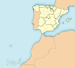
El Tanque
Appearance
El Tanque | |
|---|---|
 Municipal location in Tenerife | |
| Coordinates: 28°21′20″N 16°46′50″W / 28.35556°N 16.78056°W | |
| Country | |
| Autonomous Region | Canary Islands |
| Province | Santa Cruz de Tenerife |
| Island | Tenerife |
| Area | |
• Total | 23.65 km2 (9.13 sq mi) |
| Population (2018)[2] | |
• Total | 2,670 |
| • Density | 110/km2 (290/sq mi) |
| Time zone | UTC+0 (GMT) |
| Climate | Csb |
El Tanque is a town and a municipality in the northwestern part of the island of Tenerife, one of the Canary Islands, and part of the province of Santa Cruz de Tenerife, Spain. It is located 6 km west of Icod de los Vinos and 53 km west of the island's capital Santa Cruz de Tenerife.
The population is 2,815 (2013)[3] and the area is 23.65 km².[1] The elevation is 480 m.
Historical population
[edit]| Year | Population |
|---|---|
| 1991 | 3,058 |
| 1996 | 3,247 |
| 2001 | 2,966 |
| 2002 | 3,254 |
| 2003 | 3,198 |
| 2004 | 3,111 |
| 2013 | 2,815 |
References
[edit]- ^ a b Instituto Canario de Estadística, area
- ^ Municipal Register of Spain 2018. National Statistics Institute.
- ^ Instituto Canario de Estadística Archived 2014-04-19 at the Wayback Machine, population


