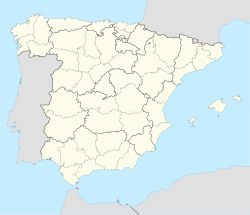
Encina de San Silvestre
Appearance
Encina de San Silvestre | |
|---|---|
 Location in Salamanca | |
| Coordinates: 41°00′50″N 6°05′35″W / 41.01389°N 6.09306°W | |
| Country | Spain |
| Autonomous community | Castile and León |
| Province | Salamanca |
| Comarca | Tierra de Ledesma |
| Government | |
| • Mayor | José Luis Vicente (People's Party) |
| Area | |
• Total | 23.76 km2 (9.17 sq mi) |
| Elevation | 800 m (2,600 ft) |
| Population (2016)[2] | |
• Total | 111 |
| • Density | 4.7/km2 (12/sq mi) |
| Time zone | UTC+1 (CET) |
| • Summer (DST) | UTC+2 (CEST) |
| Postal code | 37114 |
Encina de San Silvestre is a village and municipality in the province of Salamanca, western Spain, part of the autonomous community of Castile and León. It is located 40 kilometres (25 mi) from the provincial capital city of Salamanca and has a population of 111 people.
Geography
[edit]The municipality covers an area of 23.76 km2 (9.17 sq mi).
It lies 800 metres (2,600 ft) above sea level.
The postal code is 37114.
Spanish poet and musician Juan del Enzina was born in the village.
See also
[edit]References
[edit]- ^ a b "Municipio:Encina de San Silvestre". www.lasalina.es. Retrieved 2017-10-25.
- ^ "Salamanca: Población por municipios y sexo". www.ine.es (in Spanish). Retrieved 2017-10-25.


