Faulhorn
Appearance
| Faulhorn | |
|---|---|
 The summit with the hotel | |
| Highest point | |
| Elevation | 2,681 m (8,796 ft) |
| Prominence | 128 m (420 ft)[1] |
| Parent peak | Reeti |
| Coordinates | 46°40′29.6″N 7°59′58.8″E / 46.674889°N 7.999667°E |
| Geography | |
| Location | Bern, Switzerland |
| Parent range | Bernese Alps |
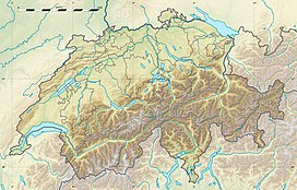
The Faulhorn is a mountain of the Bernese Alps, located between Lake Brienz and Grindelwald in the Bernese Oberland. The summit is 2,681 metres (8,796 ft) high and can be reached by several trails.
The mountain is split between the municipalities of Iseltwald and Grindelwald, with the summit located on the boundary between the two.[2]
The hotel situated on the summit of Faulhorn was built in 1830. It has undergone very little change since then.[3]
-
The old dining hall of the Faulhorn hotel
-
1870s panoramic view from Faulhorn.
Etching by Heinrich Müller
References
[edit]- ^ Retrieved from the Swisstopo topographic maps. The key col is the Reetihitta (2,553 m).
- ^ map.geo.admin.ch (Map). Swiss Confederation. Retrieved 2012-12-30.
- ^ Geschichte. www.faulhorn.ch (in German). Retrieved 2022-08-09.
External links
[edit]Wikimedia Commons has media related to Faulhorn.


