Frenchman River
| Frenchman River | |
|---|---|
 Frenchman River Valley | |
 The Milk River highlighted | |
| Location | |
| Countries |
|
| Physical characteristics | |
| Source | Cypress Lake |
| • location | Cypress Hills |
| • coordinates | 49°28′35″N 109°23′43″W / 49.47641°N 109.39518°W |
| • elevation | 975 meters (3,199 ft) |
| Mouth | Milk River |
• location | Saco, Montana |
• coordinates | 48°31′02″N 107°15′05″W / 48.517351°N 107.251295°W |
• elevation | 665 meters (2,182 ft) |
| Length | 341 kilometers (212 mi) |
| Basin features | |
| River system | Missouri River |
The Frenchman River, (Gros Ventre: níhʔɔɔtóóúníícááh, lit. 'white person river'[1]), also known locally as the Whitemud River, is a river in Saskatchewan, Canada and Montana, United States.[2] It is a tributary of the Milk River, itself a tributary of the Missouri and, in turn, part of the Mississippi River watershed, which flows to the Gulf of Mexico.[2]
The river is approximately 341 kilometers (212 mi) long.[2]
The name's origin is uncertain although both Métis and francophone settlers inhabited its banks at the turn of the 20th century. The Frenchman Formation, a stratigraphical unit of the Western Canadian Sedimentary Basin, was named for the river.
Course
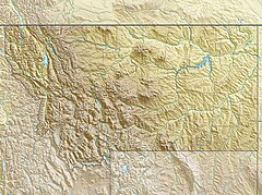
[edit]The headwaters are found in Cypress Lake,[3] in the Cypress Hills, at an elevation of 975 meters (3,199 ft). It flows east towards the community of Eastend, then turns south-east. Various reservoirs are built on its course (Eastend Reservoir, Huff Lake, and Newton Lake) and the river is used extensively for irrigation. The river becomes meandered as it flows through the Grasslands National Park. Several creeks, such as Breed Creek, Little Breed Creek, and Otter Creek, flow into the Frenchman River from the Wood Mountain Hills. After the national park and the hills, the river turns south into Montana, where it flows into the Milk River, in Phillips County, Montana, north of Saco.[4]
Fish species
[edit]Fish species found in the Frenchman River include walleye, yellow perch, northern pike, burbot, common carp, white sucker, and shorthead redhorse.[5]
See also
[edit]References
[edit]- ^ Cowell, A.; Taylor, A.; Brockie, T. "Gros Ventre ethnogeography and place names: A diachronic perspective". Anthropological Linguistics. 58 (2): 132–170. doi:10.1353/anl.2016.0025.
- ^ a b c "The Encyclopedia of Saskatchewan | Details". esask.uregina.ca. Retrieved 2022-08-04.
- ^ "Adams and Cypress Lake Reservoirs". Consul Museum. Consul Museum. Retrieved 13 February 2023.
- ^ "Frenchman River". Canadian Geographical Names Database. Government of Canada. Retrieved 10 November 2022.
- ^ "Frenchman River". Angler's Atlas. Angler's Atlas. Retrieved 18 February 2023.


