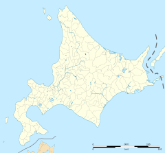
Furano Station
T30 Furano Station 富良野駅 | ||||||||||||||||
|---|---|---|---|---|---|---|---|---|---|---|---|---|---|---|---|---|
 The station building and forecourt in August 2022 | ||||||||||||||||
| General information | ||||||||||||||||
| Location | 1 Hinodecho, Furano City, Hokkaido Prefecture Japan | |||||||||||||||
| Operated by | ||||||||||||||||
| Line(s) | ||||||||||||||||
| Distance | 54.6 km (33.9 mi) from Takikawa | |||||||||||||||
| Platforms | 2 island platforms | |||||||||||||||
| Tracks | 4 | |||||||||||||||
| Connections | Bus terminal | |||||||||||||||
| Construction | ||||||||||||||||
| Structure type | At grade | |||||||||||||||
| Other information | ||||||||||||||||
| Status | Staffed | |||||||||||||||
| Station code | T30 | |||||||||||||||
| History | ||||||||||||||||
| Opened | 1 August 1900 | |||||||||||||||
| Previous names | Shimo-Furano (until 1942) | |||||||||||||||
| Passengers | ||||||||||||||||
| FY2013 | 696 daily[citation needed] | |||||||||||||||
| Services | ||||||||||||||||
| ||||||||||||||||
| ||||||||||||||||

Furano Station (富良野駅, Furano-eki) is a railway station in Furano, Hokkaido, Japan, operated by the Hokkaido Railway Company (JR Hokkaido). The station is numbered T30.[1]
Lines
[edit]Furano Station is served by the following two lines.
Station layout
[edit]The station has a "Midori no Madoguchi" staffed ticket office. Kitaca cannot be used at this station.[2]
History
[edit]The station opened on 2 December 1900 as Shimo-Furano Station (下富良野駅).[3] It was renamed simply Furano Station on 1 April 1942.[3] With the privatization of JNR on 1 April 1987, the station came under the control of JR Hokkaido.[3]
In 2024 it was decided that the Nemuro Main Line between Furano and Shintoku, would be closed permanently effective 1 April of that year, making Furano the eastern terminus of the western section of the Nemuro Main Line.[4]
Surrounding area
[edit]- National Route 38
- National Route 237
- Furano City Office
- Hokkaido Furano High School[5]
- Hokkaido Furano Ryokuho High School[6]
See also
[edit]References
[edit]- ^ "JR Hokkaido Route Map" (PDF). Hokkaido Railway Company. Archived from the original (PDF) on 7 December 2016. Retrieved 26 November 2016.
- ^ "Service Range Kitaca". JR Hokkaido. Archived from the original on 19 November 2016. Retrieved 26 November 2016.
- ^ a b c Ishino, Tetsu, ed. (1998). 停車場変遷大辞典 国鉄・JR編 [Station Transition Directory - JNR/JR]. Vol. II. Japan: JTB. pp. 874–875. ISBN 4-533-02980-9.
- ^ "JR北海道、4/1廃止の富良野~東鹿越間で増発 - 「狩勝」普通列車に". MyNavi Corporation (in Japanese). 1 January 2024. Archived from the original on 14 January 2024. Retrieved 2 February 2024.
- ^ "Hokkaido Furano High School". Official website (in Japanese). Japan: Hokkaido Furano High School. 2014. Retrieved 29 October 2014.
- ^ "Hokkaido Furano Ryokuho High School". Official website (in Japanese). Japan: Hokkaido Furano Ryokuho High School. 2012. Retrieved 29 October 2014.


