Ghawari
Appearance
Ghawari | |
|---|---|
Town | |
 Ghowari University | |
| Coordinates: 35°11′1″N 76°03′33″E / 35.18361°N 76.05917°E | |
| Country | |
| Region | Gilgit-Baltistan |
| District | Ghanche |
| Time zone | UTC+5 (PST) |
| • Summer (DST) | UTC+6 (GMT+6) |
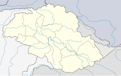
Ghawari (sometimes called Ghowari, Gowari, Oaree, Wali, and Gwali) is a small agricultural town and oasis in Ghanche District, Baltistan, Pakistan. It lies on the Shyok River about 14 miles (23 km) east of Sermik and 45.5 miles (73.2 km) southeast of Skardu. There is a suspension bridge over the Shyok in the southeast of the town which leads to Kuroo on the other side of the river.[1] It is well known as a center of Islamic scholarship and learning and for its production of cherries and associated festival. Also includes many picnic spots and view points.
History
[edit]The population of Ghawari district at the end of the 19th century was 19,445 people.[2] In 1951, Ghawari itself had a population of 1691 people.[3]
References
[edit]- ^ Ghawari, Google Maps
- ^ "Minutes of Evidence Taken by the Indian Plague Commission with Appendices, Volume 1". Indian Plague Commission, H.M. Stationery Office, 1900. 1900. p. 88.
- ^ Banat Gul Afridi: Baltistan in History (1988). Peshawar.


