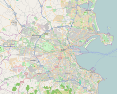
Goldenbridge Luas stop
 Goldenbridge Luas stop | |||||||||||||||||||||
| General information | |||||||||||||||||||||
| Location | Dublin Ireland | ||||||||||||||||||||
| Coordinates | 53°20′09″N 6°18′49″W / 53.33588451962098°N 6.313686597000542°W | ||||||||||||||||||||
| Owned by | Transport Infrastructure Ireland | ||||||||||||||||||||
| Operated by | Luas | ||||||||||||||||||||
| Line(s) | Red | ||||||||||||||||||||
| Platforms | 2 | ||||||||||||||||||||
| Bus routes | 1 | ||||||||||||||||||||
| Bus operators | Dublin Bus | ||||||||||||||||||||
| Connections | 123 | ||||||||||||||||||||
| Construction | |||||||||||||||||||||
| Structure type | At-grade | ||||||||||||||||||||
| Other information | |||||||||||||||||||||
| Fare zone | Red 3 | ||||||||||||||||||||
| Key dates | |||||||||||||||||||||
| 26 September 2004 | Station opened | ||||||||||||||||||||
| Services | |||||||||||||||||||||
| |||||||||||||||||||||
| |||||||||||||||||||||
| ||||||||||||||||||||||||||||||||||||||||||||||||||||||||||||||||||||||||||||||||||||||||||||||||||||||||||||||||||||||||||||||||||||||||||||||||||||||||||||||||||||||||||||||||||||||||||||||||||||||||||||||||||||||||||||||||||||||||||||||||||||||||||||||||||||||||||||||||||||||||||||||||||||||||||||
Goldenbridge (Irish: An Droichead Órga) is a stop on the Luas light-rail tram system in Dublin, Ireland. It opened in 2004 as a stop on the Red Line.[1] The stop is located next to a lock on a section of track which runs alongside the Grand Canal, near Goldenbridge Cemetery.[2]
The area is named for the Golden Bridge (formerly Glydon Bridge) which carries Emmett Road over the River Camac, some 800m away from the Luas stop. This is thought to be a corruption of Irish: gabhailín, meaning "little fork", in reference to a nearby fork in the road.[3]
The stop includes a level bridge crossing the lock, allowing access to nearby areas on the north side of the canal.
The stop is also served by Dublin Bus route 123.
Goldenbridge is intended to be a stop on the proposed Luas line to Lucan.[4]
References
[edit]- ^ "Luas is launched - 2004". RTÉ Archives.
- ^ "Goldenbridge". Luas.
- ^ "Section A" (PDF). nchplanning.
- ^ "Luas - Lucan line". boards.ie.

