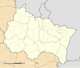
Grosbliederstroff
Appearance
Grosbliederstroff | |
|---|---|
 City hall and post office | |
| Coordinates: 49°10′N 7°02′E / 49.16°N 7.03°E | |
| Country | France |
| Region | Grand Est |
| Department | Moselle |
| Arrondissement | Sarreguemines |
| Canton | Sarreguemines |
| Intercommunality | CA Sarreguemines Confluences |
| Government | |
| • Mayor (2020–2026) | Pascal Weisslinger[1] |
Area 1 | 13.07 km2 (5.05 sq mi) |
| Population (2021)[2] | 3,297 |
| • Density | 250/km2 (650/sq mi) |
| Time zone | UTC+01:00 (CET) |
| • Summer (DST) | UTC+02:00 (CEST) |
| INSEE/Postal code | 57260 /57520 |
| Elevation | 105–357 m (344–1,171 ft) (avg. 189 m or 620 ft) |
| 1 French Land Register data, which excludes lakes, ponds, glaciers > 1 km2 (0.386 sq mi or 247 acres) and river estuaries. | |

Grosbliederstroff (French pronunciation: [ɡʁosblidɛʁstʁɔf]; German: Großblittersdorf) is a commune in the Moselle department in Grand Est in north-eastern France.
It borders the German towns of Saarbrücken (180,000 inhabitants) and Kleinblittersdorf.
Grosbliederstroff is connected to Kleinblittersdorf by a bridge and from there to Saarbrücken by tramway, and to French highways A320 and A4.
Geography
[edit]Grosbliederstroff is situated on the left bank of the river Saar (Sarre), opposite the German village Kleinblittersdorf, and about midway between Saarbrücken and Sarreguemines.
Climate
[edit]| Climate data for Grosbliederstroff | |||||||||||||
|---|---|---|---|---|---|---|---|---|---|---|---|---|---|
| Month | Jan | Feb | Mar | Apr | May | Jun | Jul | Aug | Sep | Oct | Nov | Dec | Year |
| Mean daily maximum °C (°F) | 3 (37) |
4 (39) |
9 (48) |
13 (55) |
18 (64) |
21 (70) |
23 (73) |
23 (73) |
19 (66) |
14 (57) |
7 (45) |
4 (39) |
13 (56) |
| Mean daily minimum °C (°F) | −1 (30) |
−1 (30) |
−2 (28) |
4 (39) |
8 (46) |
11 (52) |
13 (55) |
13 (55) |
10 (50) |
7 (45) |
2 (36) |
0 (32) |
5 (42) |
| Average precipitation mm (inches) | 54 (2.1) |
42 (1.7) |
38 (1.5) |
38 (1.5) |
46 (1.8) |
49 (1.9) |
50 (2.0) |
40 (1.6) |
39 (1.5) |
52 (2.0) |
59 (2.3) |
61 (2.4) |
568 (22.3) |
| Source: worldweather.org | |||||||||||||
Population
[edit]| Year | Pop. | ±% p.a. |
|---|---|---|
| 1968 | 3,218 | — |
| 1975 | 3,279 | +0.27% |
| 1982 | 3,163 | −0.51% |
| 1990 | 3,092 | −0.28% |
| 1999 | 3,334 | +0.84% |
| 2007 | 3,305 | −0.11% |
| 2012 | 3,321 | +0.10% |
| 2017 | 3,303 | −0.11% |
| Source: INSEE[3] | ||
History
[edit]777: Foundation
Former names:
- 777 : Blithario Villa
- 1220 : Bliederstroff
- 1223 : Bliderstorff
- 1594 : Grossblietersdorff
- 1756 : Blidertorf-le-Grand
- 1779 : Blidestroff-le-Gros
Sister cities
[edit] Kleinblittersdorf (Germany)
See also
[edit]References
[edit]- ^ "Répertoire national des élus: les maires". data.gouv.fr, Plateforme ouverte des données publiques françaises (in French). 9 August 2021.
- ^ "Populations légales 2021" (in French). The National Institute of Statistics and Economic Studies. 28 December 2023.
- ^ Population en historique depuis 1968, INSEE
External links
[edit] Media related to Grosbliederstroff at Wikimedia Commons


