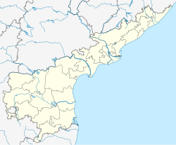
Gurazala
Gurazala | |
|---|---|
Nagar Panchayat (Gurazala-Jangamaheswarapuram) | |
 | |
 Dynamic map | |
| Coordinates: 16°35′N 79°34′E / 16.58°N 79.57°E | |
| Country | India |
| State | Andhra Pradesh |
| District | Palnadu |
| Revenue division | Gurazala |
| Assembly constituency | Gurazala |
| Mandal | Gurazala |
| Incorporated (town) | 25-01-2020 |
| Seat | Gurazala Nagar Panchayat |
| MajorAreas | Srirampuram, Jangamaheswarapuram, kattela Adithi Center, Old Lakshmi Talkies Center, The iconic Palanati Bramhanaidu Statue Center/Macherla-Guntur-Karempudi Junction Road |
| Government | |
| • Type | Municipality |
| • Body | GurazalaNagar Panchayat |
| • Member of Legislative Assembly of Andhra Pradesh | Yarapathineni Srinivasa Rao |
| Area | |
• Total | 4,341 ha (10,727 acres) |
| Population (2011(estd.))[2] | |
• Total | 35,500+(estd) |
| Languages | |
| • Official | Telugu |
| Time zone | UTC+5:30 (IST) |
| PIN | 522415 |
| Area code | +91–8649 |
| Vehicle registration | AP |
Gurazala is a town in Palnadu district in the Indian state of Andhra Pradesh. It is the headquarters of Gurazala mandal, Gurazala Assembly constituency and Gurazala revenue division.It was formed as a Nagar Panchayat combining panchayats of Gurazala and (J.M.Puram) Jangamaheswarapuram in 2020 by the government of Andhra Pradesh. The town has a history over 900+ years in the historical palnadu times (11th century) and served as the headquarters/capital of the region during 11th century.[3][4]
History
[edit]The battle of Palnadu took place between Gurazala and Macherla between 1176 AD – 1182 AD at Karampudi (Yuddabhoomi). Gurazala is capital of Palnadu kingdom. This is one of the historical places in Andhra pradesh.[5]
Geography
[edit]Gurazala is situated at 16°35′N 79°34′E / 16.58°N 79.57°E. It is spread over an area of 4,341 ha (10,730 acres).[1]
Governance
[edit]Gurazala nagar panchayat is the municipal body of the town.[6]
| Department | Incharge |
|---|---|
| Legislative | Gurazala MLA, Gurazala Municipality Chairman |
| Executive | Gurazala RDO, Gurazala MRO |
| Judiciary | Hon'ble Gurazala Court Judge, Addl.District Court Complex. |
| Police Sub Division | Gurazala DSP |
| Health | PHC,UHC Gurazala |
Culture
[edit]Amaralingeswara Swami Temple is located in the village of Daida Bilam, near Gurazala. The temple features a significant Shiva Lingam and a large Nandi, both situated inside a small cave (Bilam). The temple's central feature is the Nagarjunasila, under which the main Shiva Lingam is located. Additionally, the temple includes a common arched structure that houses deities such as Lord Shiva, Bramaramba Devi, Ganesha, and Subramanya Swamy.[7]
Notable people
[edit]- Nayakuralu Nagamma, minister of the Gurajala faction who led the army against Macherla faction in the Battle of Palnadu,[8]
- Kaneganti Hanumanthu, started the Palnadu Rebellion against taxes.
- Palnati Bramhanaidu, Minister of Palnadu Kingdom and a great social reformer of medieval india.
- Kavuri Venkaiah, a freedom fighter, started training institutes for teachers and free education for many poor people around the Palnadu area.[9][10]
Education
[edit]The village had 25 schools in 2018–2019, including one each of government, model, KGBV and state welfare residential schools; 11 private and 10 Zilla/Mandal Parishad schools.[11] Jagarlamudi Zilla Parishad High School is a district council funded school, which provides Secondary education in the village.[12]
References
[edit]- ^ a b "District Census Hand Book : Guntur (Part B)" (PDF). Census of India. Directorate of Census Operations, Andhra Pradesh. 2011. pp. 14, 204. Retrieved 2 June 2019.
- ^ "Population". Census of India. Registrar General and Census Commissioner of India. Retrieved 8 May 2019.
- ^ "District Census Handbook : Guntur (Part A)" (PDF). Census of India. Directorate of Census Operations, Andhra Pradesh. 2011. pp. 5, 232–233. Retrieved 4 June 2019.
- ^ "New Gurazala revenue division created". The Hindu. Gurazala (Guntur District). 1 July 2013. Retrieved 17 January 2015.
- ^ Roghair, G.H., The Epic of Palnadu, 1982, Clarendon Press; ISBN 0-19-815456-9
- ^ "nagar Panchayat Identification Codes" (PDF). Saakshar Bharat Mission. National Informatics Centre. p. 103. Archived from the original (PDF) on 18 August 2017. Retrieved 7 May 2019.
- ^ Chandra Rao, Dr. P. Purna (2023). Chronicle of Guntur District Tourism (1 ed.). Guntur: Acharya Nagarjuna University. p. 35.
- ^ Alf Hiltebeitel (2009). Rethinking India's Oral and Classical Epics: Draupadi among Rajputs, Muslims, and Dalits. University of Chicago Press. p. 56. ISBN 978-0-226-34055-5. Retrieved 2 March 2015.
- ^ The Atheist, Volume 8
- ^ N G, Ranga (1976). Distinguished Acquaintances (v2 ed.). Desi Book Distributors. p. 118. Retrieved 17 May 2015.
- ^ "School Information". Commissionerate of School Education. Government of Andhra Pradesh. Archived from the original on 16 April 2019. Retrieved 7 May 2019.
- ^ "List of High Schools" (PDF). Sakshi Education. Retrieved 5 May 2016.

