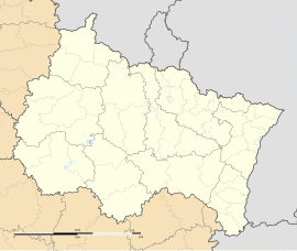
Hœrdt
You can help expand this article with text translated from the corresponding article in French. (December 2008) Click [show] for important translation instructions.
|
Hœrdt
Herdt | |
|---|---|
 The town hall in Hœrdt | |
| Coordinates: 48°41′50″N 7°47′04″E / 48.6972°N 7.7844°E | |
| Country | France |
| Region | Grand Est |
| Department | Bas-Rhin |
| Arrondissement | Haguenau-Wissembourg |
| Canton | Brumath |
| Government | |
| • Mayor (2020–2026) | Denis Riedinger[1] |
| Area 1 | 16.56 km2 (6.39 sq mi) |
| Population (2021)[2] | 4,565 |
| • Density | 280/km2 (710/sq mi) |
| Time zone | UTC+01:00 (CET) |
| • Summer (DST) | UTC+02:00 (CEST) |
| INSEE/Postal code | 67205 /67720 |
| Elevation | 128–139 m (420–456 ft) |
| 1 French Land Register data, which excludes lakes, ponds, glaciers > 1 km2 (0.386 sq mi or 247 acres) and river estuaries. | |
Hœrdt (French pronunciation: [œʁt]; German: Hördt) is a commune in the Bas-Rhin department in Grand Est in north-eastern France.[3]
Geography
[edit]Hœrdt is positioned between Strasbourg and Haguenau, a short distance to the south-east of Brumath. The commune is traversed by departmental road RD 37 which leads to Bischwiller some ten kilometres (six miles) to the north and from where it is possible to access the Autoroute A35 north-south autoroute connecting Strasbourg with Ludwigshafen (subject to a ten-minute stretch on single carriageway road to the north of the frontier). Hœrdt is also served by a local rail service.
Population
[edit]| Year | Pop. | ±% p.a. |
|---|---|---|
| 1968 | 3,819 | — |
| 1975 | 3,792 | −0.10% |
| 1982 | 3,699 | −0.35% |
| 1990 | 3,836 | +0.46% |
| 1999 | 4,123 | +0.80% |
| 2007 | 4,429 | +0.90% |
| 2012 | 4,408 | −0.10% |
| 2017 | 4,370 | −0.17% |
| Source: INSEE[4] | ||
Economy
[edit]Agriculture is important to the local economy: the main crop is, famously, asparagus.
Sport
[edit]Sports lovers are served by various facilities:
- Strasbourg-Hoerdt Horse racing circuit
- Municipal football stadium and culture centre
- Table tennis: The Hœrdt Table Tennis association, enjoys enthusiastic support locally. It is affiliated to the FFTT (French Table Tennis federation).
See also
[edit]References
[edit]- ^ "Répertoire national des élus: les maires" (in French). data.gouv.fr, Plateforme ouverte des données publiques françaises. 13 September 2022.
- ^ "Populations légales 2021" (in French). The National Institute of Statistics and Economic Studies. 28 December 2023.
- ^ INSEE commune file
- ^ Population en historique depuis 1968, INSEE


