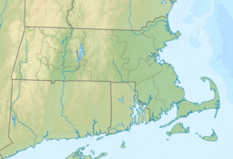
Hocomonco Pond
| Hocomonco Pond | |
|---|---|
 Hocomonco Pond | |
| Location | Westborough, Massachusetts |
| Coordinates | 42°16′21″N 71°38′58″W / 42.27250°N 71.64944°W |
| Type | Pond |
| Basin countries | United States |
| Surface area | 27 acres (11 ha) |
| Surface elevation | 276 ft (84 m) |
| References | [1] |
| Superfund site | |
| Information | |
| CERCLIS ID | MAD980732341 |
| Contaminants | Creosote |
| Progress | |
| Proposed | December 30, 1982 |
| Listed | September 8, 1983 |
| Construction completed | September 22, 1999 |
| List of Superfund sites | |
Hocomonco Pond is a recreational pond located in Westborough, Massachusetts near Route 9. Also called Hobomoc Pond, it was named for Hobomok, a Wamesit Indian evil spirit.[1] The pond and adjacent land are a Superfund site.
Superfund site
[edit]A wood treatment and preservation plant operated on a 23-acre (9.3 ha) site near the pond during the 1930s and 1940s. The business saturated wood products (e.g. telephone poles, railroad ties, pilings and fence posts) with creosote to preserve them. During the treatment process, excess creosote and wastes where discharged to an unlined pit, the "former lagoon". The creosote, which contains carcinogenic polyaromatic hydrocarbon (PAH) compounds, seeped into sediments, soil and groundwater. A storm drain built in the 1970s along the east side of the former lagoon transported liquid contaminants to the pond. The site was added to the National Priorities List on September 8, 1983. [2][3]
A 1985 Record of Decision specified remedies for cleaning up the site. A landfill for the contaminants was constructed at the former lagoon. The storm drain was relocated. Contaminated soil, waste and sediments were excavated and dredged in operations completed in 1996. The former lagoon area was then capped. The groundwater remains contaminated.[2][4]
References
[edit]- ^ a b "Hocomonco Pond". Geographic Names Information System. United States Geological Survey, United States Department of the Interior. Retrieved 2014-01-09.
- ^ a b "Waste Site Cleanup & Reuse in New England - Hocomonco Pond". U.S. Environmental Protection Agency. Retrieved 2014-01-09.
- ^ "Sins Of The Past - Industry is no longer the environment's enemy. Can the fragile truce last?". Worcester Business Journal Online. June 14, 2010. Retrieved 2014-01-09.
- ^ "Second Five-Year Review Report for Hocomonco Pond Superfund Site" (PDF). U.S. Environmental Protection Agency. September 2009. Retrieved 2014-01-09.
![]() This article incorporates public domain material from websites or documents of the Environmental Protection Agency.
This article incorporates public domain material from websites or documents of the Environmental Protection Agency.
EPA Documents & Data
[edit]https://cumulis.epa.gov/supercpad/SiteProfiles/index.cfm?fuseaction=second.docdata&id=0100751


