Hohenklingen Castle
| Hohenklingen Castle | |
|---|---|
Schloss Hohenklingen | |
| Stein am Rhein | |
 Hohenklingen Castle, after 2008 renovation | |
| Coordinates | 47°40′0″N 8°51′30″E / 47.66667°N 8.85833°E |
| Type | hill castle, spur castle |
| Code | CH-SH |
| Site information | |
| Condition | Generally preserved |
| Site history | |
| Built | 1225 |
| Garrison information | |
| Occupants | Freiherren |
| Airfield information | |
| Elevation | 594 m above the sea AMSL |

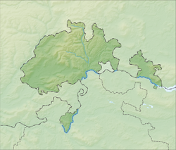
Hohenklingen Castle is a castle in the municipality of Stein am Rhein of the Canton of Schaffhausen in Switzerland.
It is a Swiss heritage site of national significance.[1]
Hohenklingen is nominated for the Swiss Location Award 2021.[2]
The Castle has been spared from war damage in the course of its history. Its silhouette with walls and roofs still corresponds to the medieval appearance from 1200 to 1422.
Hohenklingen was the first toll castle at the river Rhine and is about 5 miles away from the Rhine Falls. Stein am Rhein is also the last town before the German Border. Lake Constance ends here and is part of the border between Switzerland and Germany, with Germany on the north bank and Switzerland on the south, except both sides are Swiss in Stein am Rhein, where the High Rhine flows out of the lake.
See also
[edit]References
[edit]- ^ "Swiss inventory of cultural property of national and regional significance". A-Objects. Federal Office for Cultural Protection (BABS). 1 January 2017. Archived from the original on 2 September 2016. Retrieved 6 September 2017.
- ^ Nachrichten, Frauenfelder. "Burg Hohenklingen nominiert". Frauenfelder Nachrichten (in German). Retrieved 2021-06-18.
External links
[edit]


