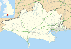
Iford, Dorset
Appearance
This article needs additional citations for verification. (October 2019) |
Iford (/ˈaɪfərd/) is a suburb of Bournemouth, situated in the eastern part of the borough. It is also known as a bridging point over the River Stour, connecting Bournemouth with Christchurch.
The parish church of St Saviour's was built in 1935–36.[1]
Politics
[edit]Iford is part of the Littledown and Iford ward for elections to Bournemouth, Christchurch and Poole Council which elect two councillors.
Iford is part of the Bournemouth East parliamentary constituency, for elections to the House of Commons of the United Kingdom.
References
[edit]- ^ "Consecration of St. Saviour's, Iford". The Bournemouth Graphic. 25 September 1936. Retrieved 5 September 2019 – via British Newspaper Archive.
Wikimedia Commons has media related to Iford, Dorset.


