Kārsava
Appearance
This article needs additional citations for verification. (April 2022) |
Kārsava | |
|---|---|
Town | |
 Cultural centre in Kārsava | |
| Coordinates: 56°47′N 27°40′E / 56.783°N 27.667°E | |
| Country | |
| Municipality | Ludza Municipality |
| Town rights | 1928 |
| Area | |
• Total | 4.07 km2 (1.57 sq mi) |
| • Land | 4.02 km2 (1.55 sq mi) |
| • Water | 0.05 km2 (0.02 sq mi) |
| Population (2024)[2] | |
• Total | 1,843 |
| • Density | 450/km2 (1,200/sq mi) |
| Time zone | UTC+2 (EET) |
| • Summer (DST) | UTC+3 (EEST) |
| Postal code | LV-5717 |
| Calling code | +371 657 |
| Website | http://www.karsava.lv/ |
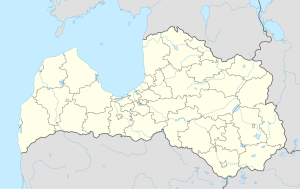
Kārsava (ⓘ; German: Karsau, Russian: Корсовка, Korsovka, Yiddish: קאָרסאָװקע, Korsovke) is a town in Ludza Municipality in the Latgale region of Latvia, near the border of Russia.
The ancient Baltic tribe Latgalians inhabited the territory of Kārsava since the 8th century. There are several hillforts near town.
In 1763 a Catholic church was built in Kārsava. The town was located near the Rēzekne-Ostrov postal road and it saw rapid development when the St. Petersburg-Vilnius railway line was constructed nearby and the town became a trading centre.
In 1935, on the eve of World War II, the population of Kārsava was 2,181, 37% of whom were Jewish.[3] The vast majority of them were murdered during the Holocaust.
See also
[edit]References
[edit]- ^ "Reģionu, novadu, pilsētu un pagastu kopējā un sauszemes platība gada sākumā". Central Statistical Bureau of Latvia. Retrieved 31 July 2024.
- ^ "Iedzīvotāju skaits pēc tautības reģionos, pilsētās, novados, pagastos, apkaimēs un blīvi apdzīvotās teritorijās gada sākumā (pēc administratīvi teritoriālās reformas 2021. gadā)". Central Statistical Bureau of Latvia. Retrieved 19 June 2024.
- ^ "1935. gada tautskaites datu pielāgojums rajonu un mūsdienu pagastu iedalījumam. - Latvijas Zinatnu Akademijas Vestis (Proceedings of the Latvian Academy of Sciences), 68(3-4): 61-84".


