Kalat County
Kalat County
Persian: شهرستان کلات | |
|---|---|
 Landscape near Spa Waterfall | |
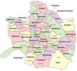
 Location of Kalat County in Razavi Khorasan province (top right, purple) | |
 Location of Razavi Khorasan province in Iran | |
| Coordinates: 36°51′N 59°52′E / 36.850°N 59.867°E[1] | |
| Country | Iran |
| Province | Razavi Khorasan |
| Capital | Kalat |
| Districts | Central, Hezarmasjed, Zavin |
| Area | |
• Total | 3,503 km2 (1,353 sq mi) |
| Population (2016)[2] | |
• Total | 36,237 |
| • Density | 10/km2 (27/sq mi) |
| Time zone | UTC+3:30 (IRST) |
| Kalat County at GEOnet Names Server | |
Kalat County (Persian: شهرستان کلات) is in Razavi Khorasan province, Iran. Its capital is the city of Kalat.[3]
History
[edit]After the 2016 National Census, Charam Rural District was created in the Central District, and Hezarmasjed Rural District was separated from it in the formation of Hezarmasjed District, including the new Layen Rural District.[4] In addition, the villages of Chenar[5] and Hasanabad-e Layen-e Now[6] were elevated to city status.
Demographics
[edit]Ethnicity
[edit]Around half of the people of Kalat County are Tekke Turkmen; 35% are Kurdish and 15% are Persian.[7]
Population
[edit]At the time of the 2006 census, the county's population was 39,560 in 9,489 households.[8] The following census in 2011 counted 38,232 people in 10,298 households.[9] The 2016 census measured the population of the county as 36,237, in 10,708 households.[2]
Administrative divisions
[edit]Kalat County's population history and administrative structure over three consecutive censuses are shown in the following table.
| Administrative Divisions | 2006[8] | 2011[9] | 2016[2] |
|---|---|---|---|
| Central District | 22,928 | 22,421 | 21,820 |
| Charam RD[a] | |||
| Hezarmasjed RD | 6,010 | 5,772 | 6,075 |
| Kabud Gonbad RD | 10,389 | 9,117 | 8,058 |
| Kalat (city) | 6,529 | 7,532 | 7,687 |
| Hezarmasjed District[a] | |||
| Hezarmasjed RD | |||
| Layen RD[a] | |||
| Hasanabad-e Layen-e Now (city)[b] | |||
| Zavin District | 16,632 | 15,811 | 14,417 |
| Pasakuh RD | 3,647 | 3,314 | 3,046 |
| Zavin RD | 8,932 | 8,408 | 7,626 |
| Chenar (city)[c] | |||
| Shahr-e Zow (city)[d] | 4,053 | 4,089 | 3,745 |
| Total | 39,560 | 38,232 | 36,237 |
| RD = Rural District | |||
See also
[edit]![]() Media related to Kalat County at Wikimedia Commons
Media related to Kalat County at Wikimedia Commons
Notes
[edit]References
[edit]- ^ OpenStreetMap contributors (1 November 2024). "Kalat County" (Map). OpenStreetMap (in Persian). Retrieved 1 November 2024.
- ^ a b c Census of the Islamic Republic of Iran, 1395 (2016): Razavi Khorasan Province. amar.org.ir (Report) (in Persian). The Statistical Center of Iran. Archived from the original (Excel) on 2 April 2022. Retrieved 19 December 2022.
- ^ Aref, Mohammad Reza (c. 2024) [Approved 18 December 1381]. Letter of approval regarding divisional reforms in Khorasan province (Zavin District, Kalat County, and the Central District). qavanin.ir (Report) (in Persian). Ministry of the Interior, Political-Defense Commission of the Cabinet of Ministers. Proposal 81741/42/1/1; Notification 58538/T26118H. Archived from the original on 7 January 2024. Retrieved 7 January 2024 – via Laws and Regulations Portal of the Islamic Republic of Iran.
- ^ a b Jahangiri, Ishaq (c. 2023) [Approved 15 February 1400]. Letter of approval regarding national divisions in Kalat County, Razavi Khorasan province. qavanin.ir (Report) (in Persian). Ministry of the Interior, Council of Ministers. Proposal 59437. Archived from the original on 30 April 2023. Retrieved 30 April 2023 – via Laws and Regulations Portal of the Islamic Republic of Iran.
- ^ a b Jahangiri, Ishaq. Approval regarding the conversion of Chenar village, Zavin Rural District, Zavin District, Kalat County, Razavi Khorasan province, into a city. rrk.ir (Report) (in Persian). Ministry of the Interior. Proposal 13485. Archived from the original on 30 April 2021. Retrieved 30 April 2023.
- ^ a b "The approval of the Minister of Interior to establish municipalities in 5 cities". khabaronline.ir (in Persian). Ministry of the Interior. 15 November 1400. Archived from the original on 6 November 2021. Retrieved 30 April 2023 – via Islamic Republic News Agency.
- ^ Khosravi, Mohammad Reza (1367). Kalat Naderi (in Persian). Astan Quds Razavi Publishing House.
- ^ a b Census of the Islamic Republic of Iran, 1385 (2006): Razavi Khorasan Province. amar.org.ir (Report) (in Persian). The Statistical Center of Iran. Archived from the original (Excel) on 20 September 2011. Retrieved 25 September 2022.
- ^ a b Census of the Islamic Republic of Iran, 1390 (2011): Razavi Khorasan Province. irandataportal.syr.edu (Report) (in Persian). The Statistical Center of Iran. Archived from the original (Excel) on 20 January 2023. Retrieved 19 December 2022 – via Iran Data Portal, Syracuse University.
- ^ Aref, Mohammad Reza (30 October 2019) [Approved 26 December 1383]. Divisional reforms in Kalat County in Razavi Khorasan province. rc.majlis.ir (Report) (in Persian). Ministry of the Interior, Defense Political Commission of the Government Council. Proposal 1.4.42.66537; Approval Letter 58538/T26118H; Notification 10493/T31547K. Archived from the original on 21 October 2020. Retrieved 1 November 2024 – via Islamic Parliament Research Center of the Islamic Republic of Iran.

