Koongine Cave
Appearance
| Location | [[]] |
|---|---|
| Region | South Australia |
| Coordinates | 37°57′39″S 140°32′4.1″E / 37.96083°S 140.534472°E |
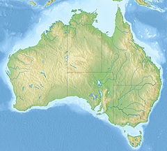
Koongine Cave is located in the Limestone Coast of South Australia.
The cave is situated in a limestone ridge approximately 4 km (2.5 mi) from the coastline. It was occupied approximately 10,000 years ago for a period of approximately 1,500 years leaving up to 2 m (7 ft) of sediments behind, rich in artefacts and ecofacts.[1]
Finger markings made by Indigenous Australians can be found on the walls of the cave.[2]
References
[edit]- ^ David Frankel (1989). "Koongine Cave excavations 1986-7: Investigating spatial patterning". Australian Archeology. Australian Archaeological Association. Archived from the original on 12 March 2017. Retrieved 18 October 2014.
- ^ Robert G. Bednarik (1989). "Perspectives of Koongine Cave and Scientistic Archeology". University of Queensland. Archived from the original on 3 March 2016. Retrieved 18 October 2014.


