Ləkit
Ləkit | |
|---|---|
Municipality | |
| Coordinates: 41°29′03″N 46°50′38″E / 41.48417°N 46.84389°E | |
| Country | |
| Rayon | Qakh |
| Population | |
• Total | 1,510 |
| Time zone | UTC+4 (AZT) |
| • Summer (DST) | UTC+5 (AZT) |
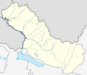
Ləkit (also, Lekit and Lyakit) is a village and municipality in the Qakh Rayon of Azerbaijan. It has a population of 1,510.[1]
History and Etymology
[edit]In written historic courses which have been saved up to the present, the village has been mentioned for the first time in a Georgian Gospel's Anderdzi (postscript), written in 1300–1310, during the reign of king George V the Brilliant of Georgia. It is said that catholicos of Georgia Ekvtime III visited Lekarti Saint Nino church, then part of the Kak-Eliseni district of the Kakheti province of Kingdom of Georgia.[2] Originally the village was called "Lekarti". The postal code is AZ 3424.
Georgian sources claim that the village's oldest name "Lekarti" (Georgian: ლექართი) is of Georgian origins and means "the place of Georgians" and that among the Dagestani Lezgins the village is also known as "Georgians' village".[3] Letifova E.M considers that actual origin of toponym of villages such as Lekit, Lekit-Ketuklu, Lekit-Malakh in former Ilisu Sultanate are derived from ethnonym of Leg tribe of Caucasian Albania.[4]
Mamirli waterfall
[edit]Mamirli waterfall (covered with moss) is located in the village of Lakit-Kotuklu in Qakh District.[citation needed]
Located at the depth of a dense forest, with a height of 15m and width of 30m. The waterfall was registered as Qakh district protected Natural habitat on August 5, 2006.[citation needed]
References
[edit]- ^ Qax Rayon İcra Hakimiyyəti: İcra Hakimiyyəti: Bələdiyyələr: Qax rayonu inzibati ərazi dairələri üzrə nümayəndəliklər və bələdiyyələr haqqında məlumat Archived 2012-12-27 at archive.today
- ^ Janashvili, Mose, "History of Georgia", Second edition by Zakaria Chichinadze, Tbilisi, 1895, p. 205, [1] (in Georgian)
- ^ Adamia, Ilia, "Georgian National Architecture", book 3, Saingilo, Tbilisi, 1979, p.p. 124-125; IB335, M-605 (in Georgian)
- ^ Letifova, E.M (1999). "Северо-западный Азербайджан: Илисуйское султанство": 25–29.
{{cite journal}}: Cite journal requires|journal=(help)
External links
[edit]


