Leadbetter Point State Park
Appearance
| Leadbetter Point State Park | |
|---|---|
 Entrance sign | |
| Location | Pacific, Washington, United States |
| Coordinates | 46°35′49″N 124°03′13″W / 46.59694°N 124.05361°W[1] |
| Area | 1,732 acres (7.01 km2) |
| Elevation | 43 ft (13 m)[1] |
| Established | 1974[2] |
| Operator | Washington State Parks and Recreation Commission |
| Website | Leadbetter Point State Park |

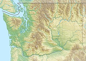
Leadbetter Point State Park is a nature preserve and public recreation area located sixteen miles (26 km) north of the city of Long Beach, Washington, at the northern tip of the Long Beach Peninsula. The state park is bounded by the Pacific Ocean to the west and Willapa Bay to the east and shares a border with the Willapa National Wildlife Refuge. The park's Martha Jordan Birding Trail goes through Hines Marsh, wintering grounds for trumpeter swans.[2] Other park activities include hiking, boating, fishing, clamming, and beachcombing.[3]
See also
[edit]References
[edit]- ^ a b "Leadbetter Point State Park". Geographic Names Information System. United States Geological Survey, United States Department of the Interior.
- ^ a b "Leadbetter Point State Park Brochure". Washington State Parks and Recreation Commission. Retrieved November 2, 2018.
- ^ "Leadbetter Point State Park". Washington State Parks and Recreation Commission. Retrieved January 21, 2015.
External links
[edit] Media related to Leadbetter Point State Park at Wikimedia Commons
- Leadbetter Point State Park Washington State Parks and Recreation Commission
- Leadbetter Point State Park Map Washington State Parks and Recreation Commission


