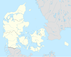
Lindved
Appearance
Lindved | |
|---|---|
Town | |
 Sindbjerg Church northwest of Lindved | |
| Coordinates: 55°47′39″N 9°34′41″E / 55.79417°N 9.57806°E | |
| Country | Denmark |
| Region | Central Denmark (Midtjylland) |
| Municipality | Hedensted Municipality |
| Parish | Sindbjerg Parish[1] |
| Area | |
| • Urban | 1.1 km2 (0.4 sq mi) |
| Population (2024)[2] | |
| • Urban | 1,440 |
| • Urban density | 1,300/km2 (3,400/sq mi) |
| Time zone | UTC+1 (CET) |
| • Summer (DST) | UTC+2 (CEST) |
| Postal code | DK-7100 Vejle |
Lindved is a town, with a population of 1,440 (1 January 2024).[2] It is located about 10 km north of Vejle in Hedensted Municipality, Central Denmark Region in Denmark.
The parish church, Sindbjerg Church, is located 2 km northwest of Lindved and 300 metres west of exit 3 at the Danish national road 18 motorway between Vejle and Holstebro.
References
[edit]- ^ Sindbjerg Parish, Vejle, Denmark Genealogy FamilySearch
- ^ a b BY3: Population 1. January by urban areas, area and population density The Mobile Statbank from Statistics Denmark


