Lowther, Cumbria
Appearance
| Lowther | |
|---|---|
 Lowther Model Village | |
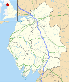
Location within Cumbria | |
| Population | 465 (2011)[1] |
| OS grid reference | NY5323 |
| Civil parish |
|
| Unitary authority | |
| Ceremonial county | |
| Region | |
| Country | England |
| Sovereign state | United Kingdom |
| Post town | PENRITH |
| Postcode district | CA10 |
| Dialling code | 01931 |
| Police | Cumbria |
| Fire | Cumbria |
| Ambulance | North West |
| UK Parliament | |
Lowther is a civil parish in Westmorland and Furness, Cumbria. Within the parish are the settlements of Lowther Village, Newtown or Lowther Newtown, Hackthorpe, Whale, and Melkinthorpe. At the 2001 census the parish had a population of 402,[2] increasing to 465 at the 2011 Census.[1]
The parish council meets at the Lowther Parish Hall in Hackthorpe. Lowther Endowed Primary School is also at Hackthorpe.
Most of the land in the parish belongs to the Lowther family estates. The family seat of the Lowthers was formerly Lowther Castle which is now a ruin but set in spectacular parkland.
Hackthorpe once had its own magistrates' court which is now part of the village's pub.
A large part of the parish is within the Lake District National Park.
See also
[edit]References
[edit]- ^ a b UK Census (2011). "Local Area Report – Lowther Parish (E04002551)". Nomis. Office for National Statistics. Retrieved 10 April 2021.
- ^ UK Census (2001). "Local Area Report – Lowther Parish (16UF042)". Nomis. Office for National Statistics. Retrieved 10 April 2021.
External links
[edit]- Cumbria County History Trust: Lowther (nb: provisional research only – see Talk page)
- www.lowther.co.uk The website of the Lowther Estates

