Lutín
Lutín | |
|---|---|
 Sigma Lutín factory | |
| Coordinates: 49°33′30″N 17°8′9″E / 49.55833°N 17.13583°E | |
| Country | |
| Region | Olomouc |
| District | Olomouc |
| First mentioned | 1234 |
| Area | |
• Total | 8.20 km2 (3.17 sq mi) |
| Elevation | 236 m (774 ft) |
| Population (2024-01-01)[1] | |
• Total | 3,234 |
| • Density | 390/km2 (1,000/sq mi) |
| Time zone | UTC+1 (CET) |
| • Summer (DST) | UTC+2 (CEST) |
| Postal codes | 783 42, 783 49 |
| Website | www |
Lutín is a municipality and village in Olomouc District in the Olomouc Region of the Czech Republic. It has about 3,200 inhabitants.
Administrative parts
[edit]The village of Třebčín is an administrative part of Lutín.
Geography
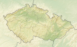
[edit]Lutín is located about 8 kilometres (5 mi) southwest of Olomouc. It lies in a flat agricultural landscape in the Upper Morava Valley.
History
[edit]The first written mention of Lutín is from 1234. Třebčín was first mentioned in 1131. Until the establishment of an independent municipality in 1850, Lutín was continuously a property of the bishopric and later archbishopric in Olomouc.[2]
Demographics
[edit]
|
|
| ||||||||||||||||||||||||||||||||||||||||||||||||||||||
| Source: Censuses[3][4] | ||||||||||||||||||||||||||||||||||||||||||||||||||||||||
Economy
[edit]Lutín has a tradition of pumpmaking industry. A pumpmaking manufacture was founded here by Ludvík Sigmund in 1868 and later became the biggest producer of pumps in the country. Since 1965, the company has been known as Sigma Lutín.[5][6] In 1966, the company became a sponsor of the club SK Sigma Olomouc.[7]
Transport
[edit]The village of Třebčín is located on the railway line Prostějov–Červenka.[8]
Sights
[edit]
There are two protected cultural monuments in the municipality: a late Baroque statue of an angel from the 1730s and the Chapel of Saint Florian from the beginning of the 19th century.[9]
References
[edit]- ^ "Population of Municipalities – 1 January 2024". Czech Statistical Office. 2024-05-17.
- ^ "Symboly obce" (in Czech). Obec Lutín. Retrieved 2022-01-13.
- ^ "Historický lexikon obcí České republiky 1869–2011" (in Czech). Czech Statistical Office. 2015-12-21.
- ^ "Population Census 2021: Population by sex". Public Database. Czech Statistical Office. 2021-03-27.
- ^ "Historie obce" (in Czech). Obec Lutín. Retrieved 2022-01-13.
- ^ "History". SIGMA GROUP a.s. Retrieved 2022-01-13.
- ^ "Dějiny klubu" (in Czech). SK Sigma Olomouc. Retrieved 2022-01-13.
- ^ "Detail stanice Třebčín" (in Czech). České dráhy. Retrieved 2023-11-07.
- ^ "Výsledky vyhledávání: Kulturní památky, obec Lutín". Ústřední seznam kulturních památek (in Czech). National Heritage Institute. Retrieved 2024-07-17.


