Lydham
Appearance
| Lydham | |
|---|---|
 Lydham church | |
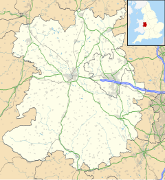
Location within Shropshire | |
| Population | 189 (2011)[1] |
| OS grid reference | SO334909 |
| Civil parish |
|
| Unitary authority | |
| Ceremonial county | |
| Region | |
| Country | England |
| Sovereign state | United Kingdom |
| Post town | BISHOPS CASTLE |
| Postcode district | SY9 |
| Dialling code | 01588 |
| Police | West Mercia |
| Fire | Shropshire |
| Ambulance | West Midlands |
| UK Parliament | |
Lydham is a small village and civil parish in Shropshire, England.
Lydham is situated on the junction of the A488 and the A489 main roads, about 2 miles (3.2 km) north of Bishop's Castle.[2]
There is a market held on Fridays in the village hall. Close by is the small village and separate parish of More.
History
[edit]Two miles to the south-east, in the parish of Lydham, are the fragmentary remains of Lea Castle, adjoining a modern farmhouse at Lower Lea.[3]
Railway
[edit]Lydham was served by the now defunct Bishops Castle Railway which closed in 1935. The station was nearby at Lydham Heath.
See also
[edit]References
[edit]- ^ "Civil Parish population 2011". Retrieved 22 November 2015.
- ^ Ordnance Survey mapping
- ^ "REMAINS OF LEA CASTLE ADJOINING LOWER LEA FARMHOUSE TO NORTH, Lydham - 1054509 | Historic England".
External links
[edit]Wikimedia Commons has media related to Lydham.

