Mengíbar
Mengíbar | |
|---|---|
 Guadalquivir river and the town of Mengíbar behind | |
| Coordinates: 37°58′06″N 03°48′32″W / 37.96833°N 3.80889°W | |
| Country | Spain |
| Autonomous community | Andalusia |
| Province | Jaén |
| Area | |
• Total | 62.35 km2 (24.07 sq mi) |
| Elevation | 323 m (1,060 ft) |
| Population (2018)[1] | |
• Total | 9,927 |
| • Density | 160/km2 (410/sq mi) |
| Time zone | UTC+1 (CET) |
| • Summer (DST) | UTC+2 (CEST) |
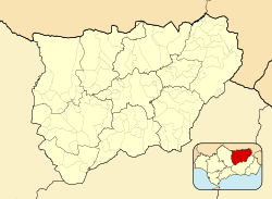
Mengíbar is municipality of Spain belonging to the province of Jaén, in the autonomous community of Andalusia. The municipality has a total area of 62.34 km2 and, as of 1 January 2022, it has a registered population of 9,965.[2]
History
[edit]Lying on the point where the Guadalbullón flows into the Guadalquivir river and also close to the Guadalimar, the nearby Iberian oppidum of Illiturgi (Cerro de la Muela) was besieged and destroyed by Scipio Africanus in 206 BCE during the Second Punic War.[3]
Mengíbar was conquered by Ferdinand III of Castile together with other neighbouring fortified places as a part of the preliminary steps leading to the 1246 siege of Jaén.[4] It was a hamlet belonging to the land of Jaén in the lower middle ages.[5] It segregated from the land of Jaén in 1574.[6]
Sports
[edit]- CD Mengíbar (2008), association football club
References
[edit]- ^ Municipal Register of Spain 2018. National Statistics Institute.
- ^ "Datos del Registro de Entidades Locales". Ministerio de Asuntos Económicos y Transformación Digital. Retrieved 29 November 2023.
- ^ Moreno Padilla, María Isabel; Lechuga Chica, Miguel Ángel; Gutiérrez-Rodríguez, Mario; Rueda Galán, Carmen; Castuera Bravo, Carolina; Bellón Ruiz, Juan Pedro (2023). "Iliturgi, from oppidum to civitas. Archaeological methodology for the investigation of an urban transformation process". Les agglomérations dans le monde celtique et ses marges. Nouvelles approches et perspectives de recherche, Pessac, Ausonius Éditions, collection. doi:10.46608/nemesis1.9782356135285.11.
- ^ Castillo Armenteros, Juan Carlos; Alcázar Hernández, Eva María (2006). "La campiña del Alto Guadalquivir en la Baja Edad Media. La dinámica de un espacio fronterizo" [The Campiña of Upper Guadalquivir in the Late Middle Ages. The Dynamics of a Borderland Area]. Studia Historica. Historia Medieval. 24. Salamanca: Ediciones Universidad de Salamanca. ISSN 0213-2060.
- ^ Alcázar Hernández, Eva María. "Formación y articulación de un concejo fronterizo: Jaén en el Siglo XIII". Arqueología y Territorio Medieval. 10 (2). Jaén: UJA Editorial: 271–272, 278. doi:10.17561/aytm.v10i2.1561. ISSN 1134-3184.
- ^ Ferrer Rodríguez, Amparo; Nieto Calmaestra, José Antonio; Camarero Bullón, Concepción (2000). "La organización territorial de la provincia de Jaén, 1750-2000: permanencia y cambio" (PDF). CT: Catastro. 39: 44. ISSN 1138-3488.


