Muráň
Muráň | |
|---|---|
Village | |
 Cigánka hill (935 m) above the village, with the ruins of the Muráň Castle | |
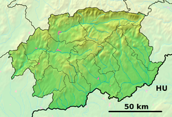
Location of Muráň in the Banská Bystrica Region | |
| Coordinates: 48°44′30″N 20°03′00″E / 48.74167°N 20.05000°E | |
| Country | |
| Region | Banská Bystrica |
| District | Revúca |
| First mentioned | 1321 |
| Government | |
| • Mayor | Roman Goldschmidt (independent) |
| Area | |
| • Total | 103.15[2] km2 (39.83[2] sq mi) |
| Elevation | 393[3] m (1,289[3] ft) |
| Population (2021) | |
| • Total | 1,221[1] |
| Time zone | UTC+1 (CET) |
| • Summer (DST) | UTC+2 (CEST) |
| Postal code | 049 01[3] |
| Area code | +421 58[3] |
| Website | www |
Muráň (earlier Podmuráň, German: Untermuran, Hungarian: Murányalja) is a village and municipality in Revúca District in the Banská Bystrica Region of Slovakia.
Geography
[edit]The village is located around 9 km north of Revúca, in the Muráň river valley. The Muráň Plateau is located north and west of the village, with the governing body of the Muránska planina National Park seated in the village.
Transportation
[edit]The village was connected to the railway network in the 1893. Nonetheless, the sole regular train connection to Plešivec was abolished in 2011. As of 2024, train connection to the village is only active during the summer season.[5]
Demography
[edit]According to the 2021 census, the village had about 1,200 inhabitants, including over 200 children. About 70% of inhabitants are Roman Catholics, 4% Lutherans and 16% are without religious affiliation.[6] According to 2019 estimate, about a third of villagers are Roma.[7]
History
[edit]The village was first mentioned in 1321 as a settlement under the Muráň Castle. Surviving written sources confirm major iron mining activities in the vicinity of the village in the mid 15th and 16th centuries. In 1574 the village was sacked by the Ottomans, who killed or enslaved nearly all inhabitants. In 1610 the village was sacked by the forces of Stephen Bocskai. A plague in 1709 and 1710 resulted in 446 dead villagers. In the 19th century the village enjoyed a period of prosperity due to an establishment of a pottery manufacture. During the World War II, Nazi soldiers killed 12 villagers as a punishment for several men from the village joining the Slovak National Uprising.[8]
The deposed Bulgarian tsar Ferdinand I of Bulgaria lived in the Predná Hora mansion after being exiled from his homeland. The manor is now a rehabilitation facility.
The preserved historical buildings in the village are the classicist townhall built in 1806, Tossay's inn (later called Koruna hotel) from 1873 and a state of John of Nepomuk from the late 19th century.
-
Townhall
-
The historical Koruna hotel in the 1920s
-
The historical Koruna hotel in 2008
-
St. John of Nepomuk statue
References
[edit]- ^ "Počet obyvateľov podľa pohlavia - obce (ročne)". www.statistics.sk (in Slovak). Statistical Office of the Slovak Republic. 2022-03-31. Retrieved 2022-03-31.
- ^ a b "Hustota obyvateľstva - obce [om7014rr_ukaz: Rozloha (Štvorcový meter)]". www.statistics.sk (in Slovak). Statistical Office of the Slovak Republic. 2022-03-31. Retrieved 2022-03-31.
- ^ a b c d "Základná charakteristika". www.statistics.sk (in Slovak). Statistical Office of the Slovak Republic. 2015-04-17. Retrieved 2022-03-31.
- ^ a b "Hustota obyvateľstva - obce". www.statistics.sk (in Slovak). Statistical Office of the Slovak Republic. 2022-03-31. Retrieved 2022-03-31.
- ^ Bartošová, Nikola (23 June 2022). "Letným vlakom máš hory ešte bližšie". HIKEMATES (in Slovak). Retrieved 19 July 2024.
- ^ "SODB2021 - Obec". www.scitanie.sk. Retrieved 19 July 2024.
- ^ "Atlas rómskych komunít 2019". www.romovia.vlada.gov.sk. Retrieved 19 July 2024.
- ^ "History of Muráň". Retrieved 19 July 2024.
External links
[edit] Media related to Muráň at Wikimedia Commons
- Official website


