Osov (Beroun District)
Osov | |
|---|---|
 Osov Castle | |
| Coordinates: 49°50′40″N 14°5′2″E / 49.84444°N 14.08389°E | |
| Country | |
| Region | Central Bohemian |
| District | Beroun |
| First mentioned | 1225 |
| Area | |
• Total | 2.45 km2 (0.95 sq mi) |
| Elevation | 365 m (1,198 ft) |
| Population (2024-01-01)[1] | |
• Total | 323 |
| • Density | 130/km2 (340/sq mi) |
| Time zone | UTC+1 (CET) |
| • Summer (DST) | UTC+2 (CEST) |
| Postal code | 267 25 |
| Website | www |
Osov is a municipality and village in Beroun District in the Central Bohemian Region of the Czech Republic. It has about 300 inhabitants.
Administrative parts
[edit]The village of Osovec is an administrative part of Osov.
Geography
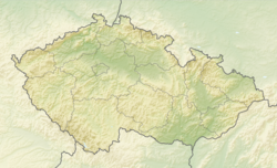
[edit]Osov is located about 13 kilometres (8 mi) south of Beroun and 31 km (19 mi) southwest of Prague. It lies in an agricultural landscape in the Hořovice Uplands. The highest point is at 411 m (1,348 ft) above sea level.
History
[edit]The first written mention of Osov is from 1225. It was the centre of a small estate, owned predominantly by various lower noble families. Until the early 18th century, the owners often changed. From the beginning of the 18th century until 1804, Osov was a property of the Kaunitz family and experienced its greatest development.[2]
Demographics
[edit]
|
|
| ||||||||||||||||||||||||||||||||||||||||||||||||||||||
| Source: Censuses[3][4] | ||||||||||||||||||||||||||||||||||||||||||||||||||||||||
Transport
[edit]Osov is located on the railway line of local importance from Lochovice to Zadní Třebaň.[5]
Sights
[edit]The main landmark of Osov is the Osov Castle. It was built in the late Baroque style in 1728–1735 for Jan Adolf of Kaunitz. It is surrounded by a park.[6]
The regular agricultural landscape around Osov with a net of paths lined with avenues is protected as a landscape monument zone. It was established in two phases after the Thirty Years' War and after 1805.[7]
References
[edit]- ^ "Population of Municipalities – 1 January 2024". Czech Statistical Office. 2024-05-17.
- ^ "Historie obce" (in Czech). Obec Osov. Retrieved 2024-01-29.
- ^ "Historický lexikon obcí České republiky 1869–2011" (in Czech). Czech Statistical Office. 2015-12-21.
- ^ "Population Census 2021: Population by sex". Public Database. Czech Statistical Office. 2021-03-27.
- ^ "Detail stanice Osov" (in Czech). České dráhy. Retrieved 2024-01-29.
- ^ "Zámek" (in Czech). National Heritage Institute. Retrieved 2024-01-29.
- ^ "Osovsko – krajinná památková zóna" (in Czech). National Heritage Institute. Retrieved 2024-01-29.


