Povrly
Povrly | |
|---|---|
 Church of the Visitation of the Virgin Mary | |
| Coordinates: 50°40′22″N 14°9′38″E / 50.67278°N 14.16056°E | |
| Country | |
| Region | Ústí nad Labem |
| District | Ústí nad Labem |
| First mentioned | 1186 |
| Area | |
• Total | 25.57 km2 (9.87 sq mi) |
| Elevation | 143 m (469 ft) |
| Population (2024-01-01)[1] | |
• Total | 2,261 |
| • Density | 88/km2 (230/sq mi) |
| Time zone | UTC+1 (CET) |
| • Summer (DST) | UTC+2 (CEST) |
| Postal codes | 400 02, 403 32 |
| Website | www |
Povrly (German: Pömmerle or Pömerle) is a municipality and village in Ústí nad Labem District in the Ústí nad Labem Region of the Czech Republic. It has about 2,300 inhabitants.
Administrative parts
[edit]The villages of Mírkov, Neštědice, Roztoky and Slavošov are administrative parts of Povrly.
Geography
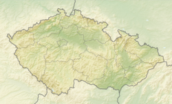
[edit]Povrly is located about 8 kilometres (5 mi) east of Ústí nad Labem. It lies in Central Bohemian Uplands and in the eponymous protected landscape area. The highest point is the hill Slavošov at 594 m (1,949 ft) above sea level. The municipality is situated on the left bank of the Elbe River.
History
[edit]The first written mention of Povrly is from 1186. For centuries, it belonged to the Děčín estate.[2]
Demographics
[edit]
|
|
| ||||||||||||||||||||||||||||||||||||||||||||||||||||||
| Source: Censuses[3][4] | ||||||||||||||||||||||||||||||||||||||||||||||||||||||||
Economy
[edit]There is a copper factory in Povrly, today known as Povrly Copper Industries. It was founded in 1899.[2][5]
Transport
[edit]The I/62 road (part of the European route E442) from Ústí nad Labem to Děčín passes through the municipality.
Povrly is located on the railway line Děčín–Kadaň. The municipality is served by three train stations and stops: Povrly, Povrly-Roztoky and Neštědice.[6]
Sights
[edit]
In the centre of Povrly is the Church of the Nativity of the Virgin Mary. It is a modern church, built in 1936.[7]
A historical landmark is the Church of the Nativity of Saint John the Baptist in Roztoky. It was built in 1875 on the site of an older late Baroque church. It is an architecturally atypical church built in the late Neoclassical style using Neo-Gothic and Neo-Romanesque elements.[8]
On the Blansko hill near Mírkov is the ruin of the Blansko Castle. It was first documented in 1401. In the 16th century, it lost its residential function. During the Thirty Years' War, it fell into disrepair. Today the ruin is freely accessible.[9]
References
[edit]- ^ "Population of Municipalities – 1 January 2024". Czech Statistical Office. 2024-05-17.
- ^ a b "Historie obce Povrly" (in Czech). Obec Povrly. Retrieved 2024-02-20.
- ^ "Historický lexikon obcí České republiky 1869–2011" (in Czech). Czech Statistical Office. 2015-12-21.
- ^ "Population Census 2021: Population by sex". Public Database. Czech Statistical Office. 2021-03-27.
- ^ "Povrly Copper Industries a.s." (in Czech). Povrly Copper Industries a.s. Retrieved 2024-02-20.
- ^ "Detail stanice Povrly" (in Czech). České dráhy. Retrieved 2024-02-20.
- ^ "Kostel Navštívení Panny Marie Povrly u Ústí nad Labem" (in Czech). CzechTourism. Retrieved 2024-02-20.
- ^ "Kostel Narození sv. Jana Křtitele" (in Czech). National Heritage Institute. Retrieved 2024-02-20.
- ^ "Zřícenina hradu Blansko" (in Czech). National Heritage Institute. Retrieved 2024-02-20.


