Qingyundian
Qingyundian Town
青云店镇 | |
|---|---|
 Location in Daxing District | |
| Coordinates: 39°41′03″N 116°29′45″E / 39.68417°N 116.49583°E | |
| Country | China |
| Municipality | Beijing |
| District | Daxing |
| Village-level Divisions | 2 communities 23 villages |
| Area | |
• Total | 70.48 km2 (27.21 sq mi) |
| Elevation | 28 m (92 ft) |
| Population (2020) | |
• Total | 69,612 |
| • Density | 990/km2 (2,600/sq mi) |
| Time zone | UTC+8 (China Standard) |
| Postal code | 102605 |
| Area code | 010 |
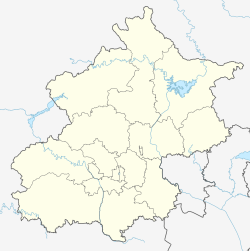
Qingyundian Town (simplified Chinese: 青云店镇; traditional Chinese: 青雲店鎮; pinyin: Qīngyúndiàn Zhèn) is a town located on northeastern Daxing District, Beijing, China. It shares border with Boxing Subdistrict and Yinghai Town to its north, Majuqiao Town to its northeast, Changziying Town to its east, Anding and Weishanzhuang Towns to its south, as well as Huangcun and Xihongmen Towns in its west. According to the 2020 census, the population of Qingyundian was 69,612.[1]
The name Qingyundian (Chinese: 青云店; lit. 'Azure Cloud Shop') originated as an evolved version of Qingrundian (Chinese: 青润店; lit. 'Azure Moist Shop'), which in turn was given for the region's rich soil and abundant water supply during the Qing dynasty.[2]
History
[edit]| Year | Status | Under |
|---|---|---|
| 1949 - 1953 | Qingyundian District | Daxing County |
| 1953 - 1958 | Qingyundian Township | |
| 1958 - 1961 | A part of Caiyu People's Commune | |
| 1961 - 1983 | Qingyundian People's Commune | |
| 1983 - 1990 | Qingyundian Township | |
| 1990 - 2001 | Qingyundian Town (Fashang Township was added in 2000) | |
| 2001–present | Daxing District |
Administrative divisions
[edit]As of the year 2021, Qingyundian Town was divided into 25 subdivisions, of those 2 were residential communities, and 23 were villages:[3]
| Administrative Division Code | Subdisvision Names | Name Transliterations | Type |
|---|---|---|---|
| 110112209001 | 于家务西里 | Yujiawu Xili | Community |
| 110112209002 | 永济 | Yongji | Community |
| 110112209201 | 于家务 | Yujiawu | Village |
| 110112209202 | 南仪阁 | Nanyige | Village |
| 110112209203 | 北辛店 | Beixindian | Village |
| 110112209204 | 大耕垡 | Dagengfa | Village |
| 110112209205 | 东马各庄 | Dong Magezhuang | Village |
| 110112209206 | 西马坊 | Xi Mafang | Village |
| 110112209207 | 神仙 | Shenxian | Village |
| 110112209208 | 果村 | Guocun | Village |
| 110112209209 | 渠头村 | Qutou Cun | Village |
| 110112209210 | 富各庄村 | Fugezhuang Cun | Village |
| 110112209211 | 满庄村 | Manzhuang Cun | Village |
| 110112209212 | 王各庄 | Wanggezhuang | Village |
| 110112209213 | 崔各庄 | Cuigezhuang | Village |
| 110112209214 | 南三间房村 | Nan Sanjianfang Cun | Village |
| 110112209215 | 小海字村 | Xiaohaizi Cun | Village |
| 110112209216 | 枣林村 | Zaolin Cun | Village |
| 110112209217 | 吴寺村 | Wusi Cun | Village |
| 110112209218 | 仇庄村 | Qiuzhuang Cun | Village |
| 110112209219 | 南刘庄 | Nanliuzhuang | Village |
| 110112209220 | 东垡村 | Dongfa Cun | Village |
| 110112209221 | 西垡村 | Xifa Cun | Village |
| 110112209222 | 后伏 | Houfu | Village |
| 110112209223 | 前伏 | Qianfu | Village |
See also
[edit]References
[edit]- ^ "北京市大兴区第七次全国人口普查公报". www.bjdx.gov.cn (in Chinese). Archived from the original on 2021-06-24. Retrieved 2022-10-22.
- ^ a b 李立国; 李万钧; 吴世民, eds. (2013). 中华人民共和国政区大典, 北京市卷. Beijing: 中国社会出版社. ISBN 978-7-5087-4058-4. OCLC 910451741.
- ^ "2021年统计用区划代码和城乡划分代码". www.stats.gov.cn. Retrieved 2022-10-22.


