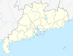
Renmin Subdistrict, Guangzhou
Appearance
Renmin Subdistrict
人民街道 | |
|---|---|
| Coordinates: 23°06′53″N 113°15′43″E / 23.11471°N 113.26188°E | |
| Country | China |
| Province | Guangdong |
| Prefecture-level city | Guangzhou |
| District | Yuexiu District |
| Time zone | UTC+8 (China Standard Time) |
Renmin Subdistrict (Chinese: 人民街道; pinyin: Rénmín Jiēdào; Jyutping: Jan4-man4 gaai1-dou6) is a subdistrict of the Yuexiu District in Guangzhou City, Guangdong Province, southern China.[1] As of 2020[update], it administers the following 15 residential neighborhoods:[2]
- Anyeli Community (安业里社区)
- Xingxianli Community (兴贤里社区)
- Haizhushi Community (海珠石社区)
- Guocaixi Community (果菜西社区)
- Qinglanli Community (青兰里社区)
- Jinghaimen Community (靖海门社区)
- Taipingtongjin Community (太平通津社区)
- Mupaitou Community (木排头社区)
- Shijiangjun Community (石将军社区)
- Dadezhong Community (大德中社区)
- Daxinzhong Community (大新中社区)
- Yudaihao Community (玉带濠社区)
- Sanfuqian Community (三府前社区)
- Zhuangyuanfang Community (状元坊社区)
- Yidexi Community (一德西社区)
Shijiangjun, Dadezhong, Daxinzhong, Yudaihao, Sanfuqian, Zhuangyuanfang and Yidexi were administered by Daxin Subdistrict (大新街道) before it was abolished in 2013.[3]
References
[edit]- ^ 2020年统计用区划代码和城乡划分代码:越秀区 (in Chinese). National Bureau of Statistics of the People's Republic of China. Retrieved 15 January 2021.
- ^ 2020年统计用区划代码和城乡划分代码:人民街道 (in Chinese). National Bureau of Statistics of the People's Republic of China. Retrieved 15 January 2021.
- ^ 广州市人民政府关于同意越秀区部分行政区划调整的批复. Government of Guangzhou. 8 February 2013. Archived from the original on 18 September 2017. Retrieved 15 January 2021.

