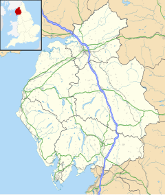
Rockcliffe railway station
Rockcliffe | |||||
|---|---|---|---|---|---|
| General information | |||||
| Location | Rockcliffe, City of Carlisle England | ||||
| Coordinates | 54°56′28″N 2°59′05″W / 54.9410°N 2.9846°W | ||||
| Grid reference | NY370611 | ||||
| Platforms | 2 | ||||
| Other information | |||||
| Status | Disused | ||||
| History | |||||
| Original company | Caledonian Railway | ||||
| Pre-grouping | Caledonian Railway | ||||
| Post-grouping | London Midland and Scottish Railway | ||||
| Key dates | |||||
| 10 September 1847 | Station opened[1] | ||||
| 1 January 1917 | Station closed[1] | ||||
| 2 December 1919 | Station reopened[1] | ||||
| 17 July 1950 | Passenger service withdrawn, but workmen's trains continued. Station renamed Rockcliffe Halt[1] | ||||
| 6 December 1965 | Station closed[1] | ||||
| |||||
Rockcliffe railway station, later Rockcliffe Halt, served the rural area around Rockcliffe, north of Carlisle in the English county of Cumberland (now part of Cumbria); it lay some distance from the village. The station was served by local trains on what is now known as the West Coast Main Line. The nearest station for Rockcliffe is now at Carlisle.
History
[edit]Opened by the Caledonian Railway,[1] it became part of the London Midland and Scottish Railway during the Grouping of 1923 and BR in 1948. It closed briefly during WW1 and was renamed as Rockcliffe Halt in 1950 when regular passenger service ceased after which it was only used by railway workers at the nearby marshalling yards until 1965.[2]
The station had a stationmaster's house, with combined ticket office and a waiting room. The line is still double track here.
| Preceding station | Historical railways | Following station | ||
|---|---|---|---|---|
| Carlisle Line and station open |
Caledonian Railway Main Line |
Floriston Line open; Station closed | ||
The site today
[edit]Trains pass through the site at speed on the electrified West Coast Main Line. The station platforms have been demolished and the pedestrian overbridge has been removed; however, the stationmaster's house remains as a private dwelling.
Caledonian Railway main line | |||||||||||||||||||||||||||||||||||||||||||||||||||||||||||||||||||||||||||||||||||||||||||||||||||||||||||||||||||||||||||||||||||||||||||||||||||||||||||||||||||||||||||||||||||||||||||||||||||||||||||||||||||||||||||||||||||||||||||||||||||||||||||||||||||||||||||||||||||||||||||||||||||||||||||||||||||||||||||||||||||||||||||||
|---|---|---|---|---|---|---|---|---|---|---|---|---|---|---|---|---|---|---|---|---|---|---|---|---|---|---|---|---|---|---|---|---|---|---|---|---|---|---|---|---|---|---|---|---|---|---|---|---|---|---|---|---|---|---|---|---|---|---|---|---|---|---|---|---|---|---|---|---|---|---|---|---|---|---|---|---|---|---|---|---|---|---|---|---|---|---|---|---|---|---|---|---|---|---|---|---|---|---|---|---|---|---|---|---|---|---|---|---|---|---|---|---|---|---|---|---|---|---|---|---|---|---|---|---|---|---|---|---|---|---|---|---|---|---|---|---|---|---|---|---|---|---|---|---|---|---|---|---|---|---|---|---|---|---|---|---|---|---|---|---|---|---|---|---|---|---|---|---|---|---|---|---|---|---|---|---|---|---|---|---|---|---|---|---|---|---|---|---|---|---|---|---|---|---|---|---|---|---|---|---|---|---|---|---|---|---|---|---|---|---|---|---|---|---|---|---|---|---|---|---|---|---|---|---|---|---|---|---|---|---|---|---|---|---|---|---|---|---|---|---|---|---|---|---|---|---|---|---|---|---|---|---|---|---|---|---|---|---|---|---|---|---|---|---|---|---|---|---|---|---|---|---|---|---|---|---|---|---|---|---|---|---|---|---|---|---|---|---|---|---|---|---|---|---|---|---|---|---|---|---|---|---|---|---|---|---|---|---|---|---|---|---|---|---|---|---|---|---|---|---|---|---|---|---|---|---|---|---|---|---|---|---|---|
Carstairs to Carlisle
| |||||||||||||||||||||||||||||||||||||||||||||||||||||||||||||||||||||||||||||||||||||||||||||||||||||||||||||||||||||||||||||||||||||||||||||||||||||||||||||||||||||||||||||||||||||||||||||||||||||||||||||||||||||||||||||||||||||||||||||||||||||||||||||||||||||||||||||||||||||||||||||||||||||||||||||||||||||||||||||||||||||||||||||
| |||||||||||||||||||||||||||||||||||||||||||||||||||||||||||||||||||||||||||||||||||||||||||||||||||||||||||||||||||||||||||||||||||||||||||||||||||||||||||||||||||||||||||||||||||||||||||||||||||||||||||||||||||||||||||||||||||||||||||||||||||||||||||||||||||||||||||||||||||||||||||||||||||||||||||||||||||||||||||||||||||||||||||||
References
[edit]Citations
[edit]Sources
[edit]- Butt, R. V. J. (October 1995). The Directory of Railway Stations: details every public and private passenger station, halt, platform and stopping place, past and present (1st ed.). Sparkford: Patrick Stephens Ltd. ISBN 978-1-85260-508-7. OCLC 60251199. OL 11956311M.
- Jowett, Alan (March 1989). Jowett's Railway Atlas of Great Britain and Ireland: From Pre-Grouping to the Present Day (1st ed.). Sparkford: Patrick Stephens Ltd. ISBN 978-1-85260-086-0. OCLC 22311137.
- Jowett, Alan (2000). Jowett's Nationalised Railway Atlas (1st ed.). Penryn, Cornwall: Atlantic Transport Publishers. ISBN 978-0-906899-99-1. OCLC 228266687.
External links
[edit]
- Railway stations in Great Britain opened in 1847
- Railway stations in Great Britain closed in 1917
- Railway stations in Great Britain opened in 1919
- Railway stations in Great Britain closed in 1965
- Disused railway stations in Cumbria
- Former Caledonian Railway stations
- 1847 establishments in England
- 1965 disestablishments in England
- Rockcliffe, Cumbria
- North West England railway station stubs


