Roquetes station
Appearance
Roquetes | |||||||||||
|---|---|---|---|---|---|---|---|---|---|---|---|
| Barcelona Metro rapid transit station | |||||||||||
 Station platform | |||||||||||
| General information | |||||||||||
| Location | Barcelona (Nou Barris) | ||||||||||
| Coordinates | 41°26′48″N 2°10′32″E / 41.44667°N 2.17556°E | ||||||||||
| Owned by | Transports Metropolitans de Barcelona | ||||||||||
| Platforms | 1 island platform | ||||||||||
| Tracks | 2 | ||||||||||
| Construction | |||||||||||
| Structure type | Underground | ||||||||||
| Other information | |||||||||||
| Fare zone | 1 (ATM) | ||||||||||
| History | |||||||||||
| Opened | 2008 | ||||||||||
| Services | |||||||||||
| |||||||||||
| |||||||||||
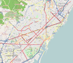
Roquetes is a Barcelona Metro station, named after the nearby Roquetes neighbourhood, in the Nou Barris district of the city of Barcelona. The station is served by line L3.[1][2]
The station can be accessed from Carrer Jaume Pinent, Carrer de les Torres and Parc de Roquetes, near Carrer Vidal i Guasch. It's a mixture of a ground-level station with the current deepest sub-surface platform in the system. The single island platform is flanked by two tracks.[1][2][3]
The station was opened on 4 October 2008, when the section of line L3 from Canyelles station to Trinitat Nova station was inaugurated.[2][3]
The current Roquetes station should not be confused with Via Júlia station, on L4, which was known as Roquetes before 1999.[4]
See also
[edit]References
[edit]- ^ a b "Plànolbcn" (in Catalan). Ajuntament de Barcelona. Retrieved 2015-01-08.
- ^ a b c "Track map of the Barcelona Metro". cartometro.com. Retrieved 2015-01-08.
- ^ a b "Roquetes" (in Catalan). trenscat.com. Retrieved 2015-01-08.
- ^ "Via Júlia" (in Catalan). trenscat.com. Retrieved 2015-01-08.
External links
[edit] Media related to Roquetes metro station at Wikimedia Commons


