Saint-Michel-des-Saints/Lac Kaiagamac Water Aerodrome
Appearance
Saint-Michel-des-Saints/Lac Kaiagamac Water Aerodrome | |||||||||||
|---|---|---|---|---|---|---|---|---|---|---|---|
 Aerial view of St-Michel-des-Saints | |||||||||||
| Summary | |||||||||||
| Airport type | <Private | ||||||||||
| Operator | Rock Martel | ||||||||||
| Serves | Saint-Michel-des-Saints | ||||||||||
| Location | Lac Kaiagamac, Quebec | ||||||||||
| Time zone | EST (UTC−05:00) | ||||||||||
| • Summer (DST) | EDT (UTC−04:00) | ||||||||||
| Elevation AMSL | 1,190 ft / 363 m | ||||||||||
| Coordinates | 46°39′04″N 073°53′39″W / 46.65111°N 73.89417°W | ||||||||||
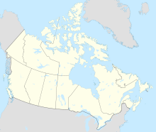
| Map | |||||||||||
 | |||||||||||
| Runways | |||||||||||
| |||||||||||
Source: Water Aerodrome Supplement[1] | |||||||||||
Saint-Michel-des-Saints/Lac Kaiagamac Water Aerodrome (TC LID: CLK4) is located on Lac Kaiagamac, 1.7 nautical miles (3.1 km; 2.0 mi) south southeast of Saint-Michel-des-Saints, Quebec, Canada.
References
[edit]- ^ Nav Canada's Water Aerodrome Supplement. Effective 0901Z 26 March 2020 to 0901Z 22 April 2021.


