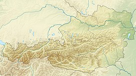
Schalfkogel
Appearance
This article relies largely or entirely on a single source. (November 2024) |
| Schalfkogel | |
|---|---|
 Schalfkogel as seen from the north from the Firmisan pass | |
| Highest point | |
| Elevation | 3,540 m (11,610 ft) |
| Prominence | 355 m (1,165 ft) |
| Parent peak | Grosser Ramolkogel |
| Listing | Alpine mountains above 3000 m |
| Coordinates | 46°48′06″N 10°57′33″E / 46.80167°N 10.95917°E |
| Geography | |
| Location | Tyrol, Austria |
| Parent range | Ötztal Alps |
| Climbing | |
| First ascent | 1830 by Frédéric Mercey |
| Easiest route | South ridge |
The Schalfkogel is a mountain in the Schnalskamm group of the Ötztal Alps.[1]
Avalanche
[edit]The 2009 Schalfkogel avalanche occurred in the municipality of Sölden (20km from the town itself), Austria on 3 May 2009. Six people were killed, five Czechs and one Slovak, when the disaster struck in the 3,500-metre (11,000 ft) Schalfkogel mountain range. The corpses were discovered to have been frozen. It was the deadliest avalanche to occur in Austria since March 2000. Although avalanches are a regular occurrence in the region, they mainly kill individuals as opposed to entire groups.[citation needed]
References
[edit]- ^ Klier, Walter (2006). Ötztaler Alpen. Bergverlag Rother. ISBN 978-3-7633-1123-1.

