Senica
Senica | |
|---|---|
Town | |
 Church of the Virgin Mary in October 2011 | |
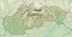
Location of Senica in the Trnava Region | |
| Coordinates: 48°40′50″N 17°22′00″E / 48.68056°N 17.36667°E | |
| Country | Slovakia |
| Region | Trnava |
| District | Senica |
| First mentioned | 1256 |
| Government | |
| • Mayor | Martin Džačovský |
| Area | |
• Total | 50.29 km2 (19.42 sq mi) |
| (2022) | |
| Elevation | 206[2] m (676[2] ft) |
| Population | |
• Total | 19,430 |
| • Density | 390/km2 (1,000/sq mi) |
| Time zone | CET (UTC+1) |
| • Summer (DST) | CEST (UTC+2) |
| Postal code | 905 01[2] |
| Area code | +421 34[2] |
| Car plate | SE |
| Website | www.senica.sk |
Senica (Slovak pronunciation: [ˈseɲitsa]; German: Senitz; Hungarian: Szenice) is a town in Trnava Region, western Slovakia. It is located in the north-eastern part of the Záhorie lowland, close to the Little Carpathians.
Etymology
[edit]The name is derived from the word seno 'hay' with the suffix -ica used to form a place name.[4]
History
[edit]Senica's history is closely related with Branč Castle, built in 1251–1261. It was first mentioned in 1256 and received its city privileges in 1396, confirmed in 1463 and 1492. The city was affected by Turkish wars, anti-Habsburg uprisings and reformation and counter-reformations in the 17th century. In 1746, it became the seat of a district within Nyitra County.[5]
Demographics
[edit]| Year | Pop. | ±% |
|---|---|---|
| 1970 | 11,383 | — |
| 1980 | 15,515 | +36.3% |
| 1991 | 20,085 | +29.5% |
| 2001 | 21,253 | +5.8% |
| 2011 | 20,255 | −4.7% |
| 2021 | 19,875 | −1.9% |
| Source: Censuses[6][7] | ||
According to the 2001 census, the city had 21,253 inhabitants. 96.40% of inhabitants were Slovaks, 1.56% Czechs, 0.84% Roma and 0.14 Hungarians.[8] The religious makeup was 47.28% Roman Catholics, 31.18% people with no religious affiliation, and 17.03% Lutherans.[8]
Industry
[edit]A significant silk-producing company is based in Senica. The company was established in 1954 under the name "Slovenský hodváb". In 2005 the production of viscose rayon was halted. After the merger of Slovenský hodváb and Kord to the new company Slovkor, it continued only with the production of Synthetic fiber for technical purposes. In February 2014 the factory chimney,[9] which dominated the city more than half century and was visible from long distance, was demolished.[10]
OMS lighting, one of the biggest luminaire companies in East-Central Europe, is also based in Senica. With around 1000 employees and exporting 98% of its production to more than 100 countries, the company is a referent in the economy of Senica.
Sport
[edit]Senica is one of the locations where Slovak Bandy Association has organised rink bandy sessions.[11][12] The club is called Športový klub Rytieri Bandy Senica and was founded in 2018.[13]
Twin towns – sister cities
[edit] Bač, Serbia (2004)
 Herzogenbuchsee, Switzerland (2004)
 Pułtusk, Poland (2002)
 Trutnov, Czech Republic (1998)
 Velké Pavlovice, Czech Republic (2002)
 Santa Tecla, El Salvador (2012)
See also
[edit]- Banská Štiavnica, Slovakia (German: Schemnitz)
- Church of the Virgin Mary (Senica)
- List of municipalities and towns in Slovakia
References
[edit]Notes
[edit]- ^ Statistical Office of the Slovak Republic (www.statistics.sk). "Hustota obyvateľstva - obce". www.statistics.sk. Retrieved 8 February 2024.
- ^ a b c d "Základná charakteristika". www.statistics.sk (in Slovak). Statistical Office of the Slovak Republic. 17 April 2015. Retrieved 31 March 2022.
- ^ Statistical Office of the Slovak Republic (www.statistics.sk). "Počet obyvateľov podľa pohlavia - obce (ročne)". www.statistics.sk. Retrieved 8 February 2024.
- ^ Štefánik, Martin; Lukačka, Ján, eds. (October 2011). Lexikón stredovekých miest na Slovensku [Lexicon of Medieval Towns in Slovakia] (PDF) (in Slovak). Bratislava: Historický ústav SAV. p. 424. ISBN 978-80-89396-11-5.
{{cite book}}: CS1 maint: year (link) - ^ Fabian, Martin; Mesároš, Ján. "Mesto Senica – oficiálne stránky". Mesto Senica.
- ^ "Statistical lexikon of municipalities 1970-2011" (PDF) (in Slovak).
- ^ "Census 2021 - Population - Basic results". Statistical Office of the Slovak Republic. 1 January 2021.
- ^ a b "Municipal Statistics". Statistical Office of the Slovak republic. Archived from the original on 17 December 2007. Retrieved 25 December 2007.
- ^ List of tallest structures in Slovakia
- ^ "V Senici padol 104 metrov vysoký komín, na jeho mieste budú obchody a byty – Záhorí.sk – správy z vašej ulice". zahori.sk. 26 February 2014.
- ^ "Poster for a rink bandy session in Senica". fbcdn.net.
- ^ "Google Translate". translate.google.co.uk. 23 November 2017.
- ^ "Športový klub Rytieri Bandy Senica hospodárenie organizácie a finančné údaje v databáze FinStat". finstat.sk.
- ^ "Partnerské mestá" (in Slovak). Senica. Retrieved 3 September 2019.
External links
[edit]![]() Media related to Senica at Wikimedia Commons
Media related to Senica at Wikimedia Commons


