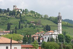
Sotto il Monte Giovanni XXIII
Appearance
Sotto il Monte
Sóta 'l Mut (Lombard) | |
|---|---|
| Città di Sotto il Monte Giovanni XXIII | |
 Sotto il Monte Giovanni XXIII | |
| Coordinates: 45°42′20″N 9°29′54″E / 45.70556°N 9.49833°E | |
| Country | Italy |
| Region | Lombardy |
| Province | Bergamo (BG) |
| Frazioni | Botta, Brusicco, Fontanella, Pratolongo |
| Government | |
| • Mayor | Denni Chiappa |
| Area | |
• Total | 5.02 km2 (1.94 sq mi) |
| Elevation | 305 m (1,001 ft) |
| Population (30 November 2016)[2] | |
• Total | 4,498 |
| • Density | 900/km2 (2,300/sq mi) |
| Demonym | Sottomontesi |
| Time zone | UTC+1 (CET) |
| • Summer (DST) | UTC+2 (CEST) |
| Postal code | 24039 |
| Dialing code | 035 |
| Patron saint | John the Baptist |
| Saint day | 24 June |
| Website | Official website |
Sotto il Monte (Bergamasque: Sóta 'l Mut; "Under the Mountain"), officially Sotto il Monte Giovanni XXIII, is a comune in northern Italy. Located in the Province of Bergamo in the Region of Lombardy, the town's official name, much like that of Riese Pio X, commemorates the town's most famous son: Angelo Giuseppe Roncalli, who later became Pope John XXIII (Italian: Giovanni XXIII).
Twin towns — sister cities
[edit]Sotto il Monte Giovanni XXIII is twinned with:
 Marktl, Germany (2009)
References
[edit]- ^ "Superficie di Comuni Province e Regioni italiane al 9 ottobre 2011". Italian National Institute of Statistics. Retrieved 16 March 2019.
- ^ "Popolazione Residente al 1° Gennaio 2018". Italian National Institute of Statistics. Retrieved 16 March 2019.


