Stakčín
Stakčín | |
|---|---|
Municipality | |
 Orthodox church of the Holy Trinity | |
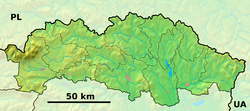
Location of Stakčín in the Prešov Region | |
| Coordinates: 49°00′10″N 22°14′30″E / 49.00278°N 22.24167°E | |
| Country | |
| Region | Prešov |
| District | Snina |
| First mentioned | 1567 |
| Area | |
| • Total | 167.74[2] km2 (64.76[2] sq mi) |
| Elevation | 252[3] m (827[3] ft) |
| Population (2021) | |
| • Total | 2,374[1] |
| Time zone | UTC+1 (CET) |
| • Summer (DST) | UTC+2 (CEST) |
| Postal code | 067 61[3] |
| Area code | +421 57[3] |
| Car plate | SV |
| Website | stakcin |
Stakčín (Hungarian: Takcsány, Rusyn: Стащін) is a larger village and a municipality in Snina District in the Prešov Region of north-eastern Slovakia.
Geography
[edit]The municipality lies in the Cirocha river valley, at an altitude of 257 metres and with a total area of 167.742 km2. According to the 2013 census it had a population of 2452 inhabitants. It lies between the Vihorlat and Bukovské vrchy mountains. The municipality is the seat of the Poloniny National Park governing body.
History
[edit]In historical records the village was first mentioned in 1492 as Staccyn. Before the establishment of independent Czechoslovakia in 1918, Stakčín was part of Zemplén County within the Kingdom of Hungary. In 1939, it was for a short time part of the Slovak Republic. The area was a battleground in the Slovak-Hungarian War of 1939, as a result of which it again became part of Hungary. On 24 November 1944, the Red Army entered Stakčín and it was once again part of Czechoslovakia.
Twin towns — sister cities
[edit]References
[edit]- ^ "Počet obyvateľov podľa pohlavia - obce (ročne)". www.statistics.sk (in Slovak). Statistical Office of the Slovak Republic. 2022-03-31. Retrieved 2022-03-31.
- ^ a b "Hustota obyvateľstva - obce [om7014rr_ukaz: Rozloha (Štvorcový meter)]". www.statistics.sk (in Slovak). Statistical Office of the Slovak Republic. 2022-03-31. Retrieved 2022-03-31.
- ^ a b c d "Základná charakteristika". www.statistics.sk (in Slovak). Statistical Office of the Slovak Republic. 2015-04-17. Retrieved 2022-03-31.
- ^ a b "Hustota obyvateľstva - obce". www.statistics.sk (in Slovak). Statistical Office of the Slovak Republic. 2022-03-31. Retrieved 2022-03-31.
- ^ "Partnerstvo". stakcin.eu (in Slovak). Stakčín. Retrieved 2019-09-09.
External links
[edit] Media related to Stakčín at Wikimedia Commons
- Official website


