Stratton Brook State Park
Appearance
| Stratton Brook State Park | |
|---|---|
 Pavilion built by the CCC | |
| Location | Simsbury, Connecticut, United States |
| Coordinates | 41°51′49″N 72°50′07″W / 41.86361°N 72.83528°W |
| Area | 145 acres (59 ha)[1] |
| Elevation | 236 ft (72 m) |
| Established | 1949[2] |
| Administered by | Connecticut Department of Energy and Environmental Protection |
| Designation | Connecticut state park |
| Website | Official website |
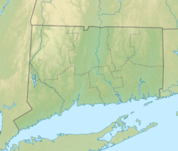
Stratton Brook State Park is a public recreation area located in the town of Simsbury, Connecticut. Among its notable features is the Massaco Forest Pavilion, built by the Civilian Conservation Corps in 1935. The state park offers picnicking, fishing, swimming, hiking, biking, cross-country skiing, and ice fishing[2] as well as a seasonal nature center.[3]
References
[edit]- ^ "Appendix A: List of State Parks and Forests" (PDF). State Parks and Forests: Funding. Staff Findings and Recommendations. Connecticut General Assembly. January 23, 2014. p. A-3. Retrieved March 20, 2014.
- ^ a b "Stratton Brook State Park". Connecticut Department of Energy and Environmental Protection. Retrieved September 3, 2024.
- ^ "Stratton Brook State Park Nature Center". CT Museum Quest. Retrieved August 8, 2013.
External links
[edit]Wikimedia Commons has media related to Stratton Brook State Park.
- Stratton Brook State Park Connecticut Department of Energy and Environmental Protection
- Stratton Brook State Park Map Connecticut Department of Energy and Environmental Protection


