Svidník
Svidník | |
|---|---|
Town | |
 Panorama of Svidník | |
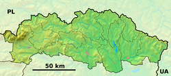
Location of Svidník in the Prešov Region | |
| Coordinates: 49°18′20″N 21°34′04″E / 49.30556°N 21.56778°E | |
| Country | |
| Region | Prešov |
| District | Svidník |
| First mentioned | 1330 |
| Government | |
| • Mayor | Marcela Ivančová |
| Area | |
• Total | 20.20 km2 (7.80 sq mi) |
| 2022 | |
| Elevation | 225[2] m (738[2] ft) |
| Population (2022)[3] | |
• Total | 9,909 |
| • Density | 490/km2 (1,300/sq mi) |
| Population by ethnicity (2011) | |
| • Slovak | 67.2% |
| • Rusyn | 19.2% |
| • Roma | 3.1% |
| • Ukrainian | 2.0% |
| • Other | 0.9% |
| • Unreported | 7.6% |
| Population by religion (2011) | |
| • Greek Catholic | 38.2% |
| • Orthodox | 25.4% |
| • Roman Catholic | 21.4% |
| • Lutheran | 0.9% |
| • Jehovah's Witness | 0.4% |
| • Other | 0.4% |
| • Non-religious | 4.8% |
| • Unreported | 8.5% |
| Time zone | UTC+1 (CET) |
| • Summer (DST) | UTC+2 (CEST) |
| Postal code | 089 01[2] |
| Area code | +421 54[2] |
| Car plate | SK |
| Website | www.svidnik.sk |
Svidník (Hungarian: Felsővízköz, German: Oberswidnik, Rusyn: Свідник, Ukrainian: Свидник) is a town in eastern Slovakia, the capital of the Svidník District in the Prešov Region. It has a population of around 11,000.
There is a monumental Soviet Army Memorial in the city, in memory of Battle of the Dukla Pass.
Geography
[edit]It is located in the Ondava Highlands, at the confluence of Ondava and Ladomírka rivers, located around 20 km (12.43 mi) from the Dukla Pass (Polish border) and around 55 km (34.18 mi) north-east of Prešov.
History
[edit]
The town arose in 1944 by merger of two formerly independent municipalities of Nižný Svidník and Vyšný Svidník. The first written mention stems from 1355 as Scyuidnyk. Before the establishment of independent Czechoslovakia in 1918, Nižný Svidník and Vyšný Svidník were part of Sáros County within the Kingdom of Hungary. From 1939 to 1945, they were part of the Slovak Republic. On 19 January 1945, the Red Army dislodged the Wehrmacht from Svidník in the course of the Western Carpathian offensive and it was once again part of Czechoslovakia.
Demographics
[edit]| Year | Pop. | ±% |
|---|---|---|
| 1970 | 3,518 | — |
| 1980 | 7,538 | +114.3% |
| 1991 | 11,520 | +52.8% |
| 2001 | 12,428 | +7.9% |
| 2011 | 11,721 | −5.7% |
| 2021 | 10,168 | −13.2% |
| Source: Censuses[6][7] | ||
According to a 2001 census, the town had 12,428 inhabitants. 79.60% of inhabitants were Slovaks, 13.04% were Rusyns, 4.07% were Ukrainian, 1.50% were of Romani descent and 0.39% were Czechs.[8] The religious make-up was 41.10% Greek Catholics, 25.82% Orthodox, 24.13% Roman Catholics, 5.17% people with no religious affiliation and 0.93% Lutherans.[8]
Twin towns — sister cities
[edit] Strzyżów, Poland
 Świdnik, Poland
 Jarosław, Poland
 Sanok County, Poland
 Chrudim, Czech Republic
 Kriva Palanka, North Macedonia
 Rakhiv, Ukraine
 Vrbas, Serbia
References
[edit]- ^ Statistical Office of the Slovak Republic (www.statistics.sk). "Hustota obyvateľstva - obce". www.statistics.sk. Retrieved 2024-02-08.
- ^ a b c d "Základná charakteristika". www.statistics.sk (in Slovak). Statistical Office of the Slovak Republic. 2015-04-17. Retrieved 2022-03-31.
- ^ Statistical Office of the Slovak Republic (www.statistics.sk). "Počet obyvateľov podľa pohlavia - obce (ročne)". www.statistics.sk. Retrieved 2024-02-08.
- ^ SODB - Svidník, 2011
- ^ SODB - Svidník, 2011
- ^ "Statistical lexikon of municipalities 1970-2011" (PDF) (in Slovak).
- ^ "Census 2021 - Population - Basic results". Statistical Office of the Slovak Republic. 2021-01-01.
- ^ a b "Municipal Statistics". Statistical Office of the Slovak republic. Archived from the original on 2007-12-17. Retrieved 2008-01-05.
- ^ "Družobné vzťahy". svidnik.sk (in Slovak). Svidník. Retrieved 2019-09-04.
External links
[edit] Media related to Svidník at Wikimedia Commons
- Official website


