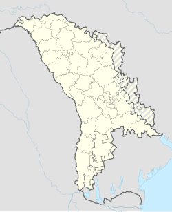
Telenești
Appearance
Telenești | |
|---|---|
 | |
| Coordinates: 47°30′10″N 28°22′0″E / 47.50278°N 28.36667°E | |
| Country | Moldova |
| Raion (district) | Telenești |
| Area | |
• Total | 536 km2 (207 sq mi) |
| Elevation | 96 m (315 ft) |
| Population | |
• Total | 7,227 |
| • Density | 13/km2 (35/sq mi) |
| Time zone | UTC+2 (EET) |
| • Summer (DST) | UTC+3 (EEST) |
Telenești (Romanian pronunciation: [teleˈneʃtʲ]) is a city in Moldova, located 91 kilometres to the north of the capital city, Chișinău. Telenești is the administrative center of the eponymous district. Three villages are administered by the city: Mihălașa, Mihălașa Nouă and Izvoraș. As of 2004, it had a population of 6,855, 89 percent of whom were Moldovan.[2]
Media
[edit]- Jurnal FM – 88.2 MHz
Notable people
[edit]- Angel Agache, Moldovan politician.
- Nicoleta Dara, singer
- Nachum Gutman (1898–1980), Teleneşti-born Israeli painter, sculptor, and author
Religion
[edit]Before World War II, the town had an important Jewish population. The Cathedral of St. Elijah from Telenești is one of the newest representative architectural monument. Țurcan Vasile is the priest of the St. Elijah Cathedral. The construction of Cathedral started in 2006.
Further reading
[edit]- Axentie Blanovschi: Telenești, Ed. Timpul Chișinău, 1986
- Teleneshty (p. 421) at Miriam Weiner's Routes to Roots Foundation
References
[edit]- ^ Results of Population and Housing Census in the Republic of Moldova in 2014: "Characteristics – Population (population by communes, religion, citizenship)" (XLS). National Bureau of Statistics of the Republic of Moldova. 2017. Retrieved 1 May 2017.
- ^ "Moldovan 2004 census results". Archived from the original on 11 June 2016. Retrieved 22 July 2008.
External links
[edit]Wikimedia Commons has media related to Telenești.


