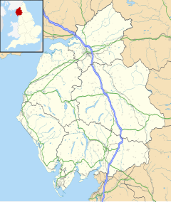
Temple Sowerby
| Temple Sowerby | |
|---|---|
 Temple Sowerby | |
Location within Cumbria | |
| Population | 528 (2011)[1] |
| OS grid reference | NY6127 |
| Civil parish |
|
| District | |
| Shire county | |
| Region | |
| Country | England |
| Sovereign state | United Kingdom |
| Post town | PENRITH |
| Postcode district | CA10 |
| Dialling code | 01768 |
| Police | Cumbria |
| Fire | Cumbria |
| Ambulance | North West |
| UK Parliament | |
Temple Sowerby is a village and civil parish in Cumbria, northern England. It is close to the main east–west A66 road about 8 miles (13 km) east of Penrith in the Eden Valley. At the 2011 census Temple Sowerby was grouped with Newbiggin giving a total population of 528.[1]
At the centre of the village is the village green surrounded by cottages and houses, the village hall, Church of England primary school and a public house and hotel. Just outside the village stands the cricket pitch, a bowling green, the new doctors surgery and the Temple Sowerby garage. The National Trust property Acorn Bank is nearby, which dates back to the days of the crusades when a member of the Knights Templar lived there. The village's association with the Knights Templar gave it the name 'Temple'. Sowerby is Viking for "a homestead with poor soil".
Transport
[edit]Railway
[edit]Temple Sowerby railway station (now a private house) was on the Eden Valley Railway between Cliburn and Kirkby Thore.
Road
[edit]The villagers of Temple Sowerby successfully campaigned for a bypass for the village[2] Construction began in the spring of 2006 and it was officially opened on Thursday 18 October 2007. There was a celebratory walk of the bypass route on Sunday 16 September 2007, allowing a unique opportunity to walk along the route before it was opened to traffic. The walk was extremely successful, with more than 500 people taking part.
See also
[edit]References
[edit]- ^ a b UK Census (2011). "Local Area Report – Temple Sowerby Parish (E04002576)". Nomis. Office for National Statistics. Retrieved 20 April 2021.
- ^ A66 Temple Sowerby Bypass and Improvements at Winderwath Archived 2006-05-29 at the Wayback Machine
External links
[edit]- Cumbria County History Trust: Temple Sowerby (nb: provisional research only – see Talk page)
- Temple Sowerby Website
- Temple Sowerby Bypass Celebration website
- Railway station site record

