Thaumasia Planum


The Thaumasia Planum of Mars lies south of Melas Chasmata and Coprates Chasmata. It is in the Coprates quadrangle. Its center is located at 21.66 S and 294.78 E. It was named after a classical albedo feature. The name was approved in 2006.[1] Some forms on its surface are evidence of a flow of lava or water the Melas Chasma. Many wrinkle ridges and grabens are visible. One set of grabens, called Nia Fossae, seem to follow the curve of Melas Chasmata which lies just to the north.[2] Some researchers have discovered dikes in this region. For the study, Thermal Emission Imaging System (THEMIS) daytime infrared images, THEMIS nighttime infrared images, CTX images, and HiRISE images were used.[3][4] These dikes contain magnesium-rich olivine which indicates a primitive magma composition. Dikes occur when magma follows cracks and faults under the ground. Sometimes erosion reveals them. The presence of pit craters, narrow grabens, linear troughs, and ovoid troughs are also evidence of dikes.[5][6][7][8] These dikes that lie close to and parallel to Valles Marineris, the great canyon system, are evidence that extensional stress aided the formation of Valles Marineris. They may be part of a system of dikes that came from the same magma source that fed the whole area. That source may have been a “plume” of molted rock that rose from the Martian mantle.[9][10]
So, the following events happened to produce the current landscape in Thaumasia Planum.
1. The mass of the volcanoes of Tharsis caused stress that resulted in fractures.[11]
2. Basalt lava flows covered the region. The flows may have come from a system of dikes.[12]
3. Wrinkle ridges formed as a result of regional compression.[13]
4. The final stage was the covering the area with volcanic ash and dust. Wind moved the surface material around.
-
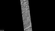
Lassell (Martian crater), as seen by CTX camera (on Mars Reconnaissance Orbiter).
-
Dikes from when magma rises to near the surface in cracks in rocks. Later erosion may have exposed them
-
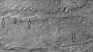
Wrinkle ridges, as seen by CTX
References
[edit]- ^ https://planetarynames.wr.usgs.gov/SearchResults?target=MARS&featureType=Planum, plana
- ^ Tanaka, K., et al. 2011. Plateau geology south of Valles Marineris, Mars: Implications for canyon formational history. EPSC Abstracts Vol. 6, EPSC-DPS2011-269, 2011 EPSC-DPS Joint Meeting 2011.
- ^ Huang, J., C. S. Edwards, B. H. N. Horgan, P. R. Christensen, M. D. Kraft, L. Xiao. 2012. Identification and mapping of dikes with relatively primitive compositions in Thaumasia Planum on Mars: Implications for Tharsis volcanism and the opening of Valles Marineris. Geophys. Res. Lett. 39. L17201, doi:10.1029/2012GL052523.
- ^ Horgan, Briony; Edwards, C. S.; Christensen, P. R.; Horgan, B. H.; Xiao, L. (6 September 2012). "Thermally Distinct Olivine-Rich Dikes in Thaumasia Planum, Mars". Geophysical Research Letters (1659): 2577. Bibcode:2012LPI....43.2577H.
- ^ Mège, D., P. Masson. 1996. A plume tectonics model for the Tharsis province, Mars. Planet. Space Sci. 44 (12), 1499 – 1546, doi:10.1016/ S0032-0633(96)00113-4.
- ^ Wilson, L., J. Head. 2002. Tharsis-radial graben systems as the surface manifestation of plume-related dike intrusion complexes: Models and implications. J. Geophys. Res. 107 (E8), 5057, doi:10.1029/ 2001JE001593.
- ^ Mège, D., et al. 2003. Volcanic rifting at Martian grabens. J. Geophys. Res. 108 (E5), 5044, doi:10.1029/2002JE001852.
- ^ Schultz, R., et al. 2004. Igneous dikes on Mars revealed by Mars Orbiter Laser Altimeter topography. Geology 32 (10), 889 – 892, doi:10.1130/G20548.1.
- ^ Huang, J., C. S. Edwards, B. H. N. Horgan, P. R. Christensen, M. D. Kraft, L. Xiao. 2012. Identification and mapping of dikes with relatively primitive compositions in Thaumasia Planum on Mars: Implications for Tharsis volcanism and the opening of Valles Marineris. Geophys. Res. Lett. 39. L17201, doi:10.1029/2012GL052523.
- ^ "Dikes: Key link between Thaumasia Planum, Tharsis, and Valles Marineris? | Red Planet Report".
- ^ Andrews-Hanna, J. 2012. The formation of Valles Marineris: 2. Stress focusing along the buried dichotomy boundary, J. Geophys. Res. 117 E04009, doi:10.1029/2011JE003954.
- ^ Flahaut, J., et al. 2011. Dikes of distinct composition intruded into Noachian-aged crust exposed in the walls of Valles Marineris, Geophys. Res. Lett. 38 L15202, doi:10.1029/2011GL048109
- ^ Golombek, M., et al. 2001. Martian wrinkle ridge topography: Evidence for subsurface faults from MOLA. J.Geophys.Res. 106 (E10), 23,811– 23,821, doi:10.1029/2000JE001308.


