Trent Vale
This article needs additional citations for verification. (January 2017) |
| Trent Vale | |
|---|---|
 The Church of St John the Evangelist in Trent Vale | |
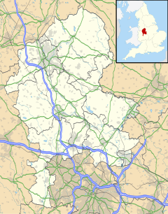
Location within Staffordshire | |
| Unitary authority | |
| Ceremonial county | |
| Region | |
| Country | England |
| Sovereign state | United Kingdom |
Trent Vale is a suburb located on the outskirts of Stoke-on-Trent in Staffordshire, England. It is bordered on the south by Hanford, to the west by Clayton, to the north by Newcastle-under-Lyme, to the southeast by Oakhill and Penkhull to the northeast. The ward it is under is called 'Springfields and Trent Vale'. The population of the ward at the 2011 census was 6,816.[1]
The area is home to the Clayton Wood Training Ground, owned by Stoke City FC.[2] Employment is provided locally by the Royal Stoke University Hospital.
Trent Vale has a church called St John the Evangelist Church, Trent Vale[3] erected in the early Gothic style in 1843. The architect was Philip Wooton.
The main road through Trent Vale is the A34, which runs from north to south through the main centre of Trent Vale.
References
[edit]- ^ "Stoke Ward population 2011". Retrieved 21 December 2015.
- ^ "Clayton Wood". Stoke City. Retrieved 24 July 2016.
- ^ Church of England: St John the Evangelist Church www.achurchnearyou.com accessed Feb 2017

