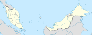
Tumpat railway station
Appearance
This article needs additional citations for verification. (November 2017) |
 | |||||||||||||||||
| General information | |||||||||||||||||
| Location | Tumpat District, Kelantan Malaysia | ||||||||||||||||
| Owned by | Keretapi Tanah Melayu | ||||||||||||||||
| Line(s) | East Coast Line | ||||||||||||||||
| Platforms | 1 side platform 1 island platform | ||||||||||||||||
| Tracks | 3 | ||||||||||||||||
| Construction | |||||||||||||||||
| Structure type | Concrete building | ||||||||||||||||
| Parking | Available, free. | ||||||||||||||||
| History | |||||||||||||||||
| Rebuilt | 2018 | ||||||||||||||||
| Electrified | No | ||||||||||||||||
| Services | |||||||||||||||||
| |||||||||||||||||
| |||||||||||||||||
The Tumpat railway station is a Malaysian railway station stationed at and named after the town of Tumpat, Kelantan. It is also the northern terminus of KTM's East Coast Line.[1]
In 2018, Tumpat station begins to upgrade project and build the depot. Tumpat train station will also be upgraded to accommodate an estimated passenger capacity of 1,500 people per day. The upgrade work of the railway station will involve the construction of a new building, an existing platform level, a full roof and a footbridge. The depot will be built with an area of 4.7 hectares to accommodate 13 units artificiality rail Diesel Multiple Units (DMU).[2][3]
Train services
[edit]- Ekspres Rakyat Timuran 26/27 Tumpat–JB Sentral
- Shuttle Timur 51/52/57/60 Tumpat–Gua Musang
- Shuttle Timur 55/56 Tumpat–Dabong
Around the station
[edit]- Tumpat railway depot
References
[edit]- ^ "Tempat Menarik di Kelantan 2021 (Aktiviti Percutian Best)". 22 June 2016.
- ^ Idris, Siti Rohana (September 27, 2018). "Peruntukan RM500 juta dilulus bagi projek besarkan LTSIP". Berita Harian.
- ^ "September 2018 – Page 40 – PORTAL SINARHARIAN". PORTAL SINARHARIAN. Retrieved 2021-12-07.
Wikimedia Commons has media related to Tumpat Railway Station.
6°11′56″N 102°10′03″E / 6.19889°N 102.16750°E

