Tzur Yitzhak
Appearance
Tzur Yitzhak
צוּר יִצְחָק | |
|---|---|
 | |
| Coordinates: 32°14′28″N 34°59′51″E / 32.24111°N 34.99750°E | |
| Country | Israel |
| District | Central |
| Council | Drom HaSharon |
| Founded | 2007 |
| Population (2022)[1] | 7,080 |
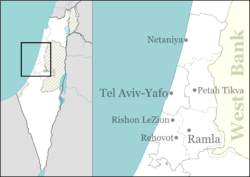
Tzur Yitzhak (Hebrew: צוּר יִצְחָק, lit. 'Rock of Yitzhak') is a community settlement in central Israel. Located near Tzur Natan and Kokhav Ya'ir, it falls under the jurisdiction of Drom HaSharon Regional Council. In 2022 it had a population of 7,080.[1]
History
[edit]The village was founded in June 2007 and named in memory of former Prime Minister Yitzhak Rabin. It initially consisted of around 140 residential units in two different projects. There were plans for a total of around 2,650 dwellings in the settlement, with its proximity to Highway 6 and attractive real estate prices assisting in its rapid growth.
On 8 September 2012 Tzur Yitzhak was officially recognized as an independent locality with a twelve-member council.
References
[edit]- ^ a b "Regional Statistics". Israel Central Bureau of Statistics. Retrieved 21 March 2024.

