Vlasotince
Vlasotince
Власотинце (Serbian) | |
|---|---|
Town and municipality | |
 Vlasotince, town centre | |
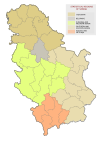
 Location of the municipality of Vlasotince within Serbia | |
| Coordinates: 42°58′N 22°08′E / 42.967°N 22.133°E | |
| Country | |
| Region | Southern and Eastern Serbia |
| District | Jablanica |
| Settlements | 48 |
| Area | |
| • Town | 15.91 km2 (6.14 sq mi) |
| • Municipality | 308 km2 (119 sq mi) |
| Elevation | 234 m (768 ft) |
| Population (2022 census)[2] | |
| • Town | 14,924 |
| • Town density | 940/km2 (2,400/sq mi) |
| • Municipality | 25,695 |
| • Municipality density | 83/km2 (220/sq mi) |
| Time zone | UTC+1 (CET) |
| • Summer (DST) | UTC+2 (CEST) |
| Postal code | 16210 |
| Area code | +381(0)16 |
| Car plates | VL |
| Website | vlasotince |

Vlasotince (Serbian Cyrillic: Власотинце) is a town and municipality located in Jablanica District of southern Serbia. As of 2022, the municipality has 25,695 inhabitants, while the town itself has a population of 14,924 inhabitants.
History
[edit]According to Turkish records, the town existed in the 15th century as a Turkish administrative center. After the Turks were forced out of Serbia, locals started growing wine grapes as a kind of complementary business to their building activities. They made Vlasotince the number one wine region in the former Yugoslavia and furthermore the biggest wine exporter in the Balkans. The craftsmanship and building skills of workers and builders from this region were appreciated in the former Yugoslavia and its surrounding neighbours until the Yugoslav Wars.
On 26 June 1988, after a period of heavy rains, Vlasina valley was a site of catastrophic floods. Extreme downpours and heavy storms affected river's watershed area in the municipalities of Vlasotince, Crna Trava, Babušnica, Pirot and Leskovac. Military was dispatched to help the residents. In Vlasotince, 1,700 buildings were flooded, 120 were completely destroyed, so as 55 artisan shops, while all major companies and economic organizations were disabled. Numerous streets were washed away, so as 17 bridges along the river, town's bus station, power station and all generators, sports fields, post offices, city waterworks, overhead power lines and Vlasotince's famous "Park" garden.[3][4] In the next period, a solidarity settlement was built in Vlasotince.
During the floods in January 2021, the army was again deployed. Severe rains and ensuing floods caused power outage in the entire municipality of Vlasotince and cut the supply of the drinking water. The river also brought large amount of garbage which clogged the small dam in town.[5][6]
Settlements
[edit]Aside from the town of Vlasotince, the municipality includes the following settlements:
According to 2022 census, the largest and the only settlement over a thousand citizens is Stajkovce (1.463).
Demographics
[edit]| Year | Pop. | ±% p.a. |
|---|---|---|
| 1948 | 33,845 | — |
| 1953 | 35,224 | +0.80% |
| 1961 | 35,625 | +0.14% |
| 1971 | 36,022 | +0.11% |
| 1981 | 35,863 | −0.04% |
| 1991 | 34,302 | −0.44% |
| 2002 | 33,312 | −0.27% |
| 2011 | 29,893 | −1.20% |
| Source: [7] | ||
According to the 2011 census results, the municipality of Vlasotince has a population of 29,893 inhabitants.
Ethnic groups
[edit]The ethnic composition of the municipality:
| Ethnic group | Population | % |
|---|---|---|
| Serbs | 28,613 | 97.54% |
| Romani | 691 | 2.36% |
| Romanians | 10 | 0.03% |
| Bulgarians | 5 | 0.02% |
| Gorani | 3 | 0.01% |
| Russians | 2 | 0.01% |
| Others | 12 | 0.04% |
| Total | 29,893 |
Economy
[edit]The following table gives a preview of total number of registered people employed in legal entities per their core activity (as of 2018):[8]
| Activity | Total |
|---|---|
| Agriculture, forestry and fishing | 46 |
| Mining and quarrying | 34 |
| Manufacturing | 2,446 |
| Electricity, gas, steam and air conditioning supply | 23 |
| Water supply; sewerage, waste management and remediation activities | 131 |
| Construction | 780 |
| Wholesale and retail trade, repair of motor vehicles and motorcycles | 810 |
| Transportation and storage | 119 |
| Accommodation and food services | 194 |
| Information and communication | 19 |
| Financial and insurance activities | 33 |
| Real estate activities | 2 |
| Professional, scientific and technical activities | 152 |
| Administrative and support service activities | 48 |
| Public administration and defense; compulsory social security | 272 |
| Education | 452 |
| Human health and social work activities | 351 |
| Arts, entertainment and recreation | 87 |
| Other service activities | 95 |
| Individual agricultural workers | 334 |
| Total | 6,429 |
Notable people
[edit]- Aleksandar Davinić, journalist
- Bogoljub Mitić Đoša, actor and comedian
- Nenad Filipović, athletics
- Predrag Filipović, athletics
- Slaviša Stojanović, football coach
- Tihomir Stanojević, police commander
- Borivoje Šurdilović (Šurda), the main character of Vruć vetar
See also
[edit]References
[edit]- ^ "Municipalities of Serbia, 2006". Statistical Office of Serbia. Retrieved 2010-11-28.
- ^ "Census 2022: Total population, by municipalities and cities". popis2022.stat.gov.rs.
- ^ Cite error: The named reference
ESNwas invoked but never defined (see the help page). - ^ Danilo Kocić (28 June 2020). Највеће ћуди мирне реке Власине [Major whims of timid Vlasina river]. Politika (in Serbian). pp. 12–13.
- ^ Danilo Kocić (12 January 2021). Власотинце без воде, села без струје [Vlasotince without water, villages in dark]. Politika (in Serbian). p. 12.
- ^ M.G. (13 January 2021). Војска помаже у Лесковцу, Власотинцу и Житорађи [Army helps in Leskovac, Vlasotince and Žitorađa]. Politika (in Serbian). p. 16.
- ^ "2011 Census of Population, Households and Dwellings in the Republic of Serbia" (PDF). stat.gov.rs. Statistical Office of the Republic of Serbia. Retrieved 12 January 2017.
- ^ "MUNICIPALITIES AND REGIONS OF THE REPUBLIC OF SERBIA, 2019" (PDF). stat.gov.rs. Statistical Office of the Republic of Serbia. 25 December 2019. Retrieved 28 December 2019.


