Virginia
Appearance
- Ing artikulung iti tungkul ya keng the U.S. State. Para kareng aliwang kabaldugan na niti, Virginia (disambiguation).
| |||||||||
| Peka Amanu | English | ||||||||
| Tungku Pekamaragul a Lakanbalen |
Richmond Virginia Beach | ||||||||
| Lapad - Eganagana - Lapad - Kaba - % danum - Latitude - Longitude |
Ranku 35th 110,862 km² 320 km 690 km 7.4 36°31'N to 39°37'N 75°13'W to 83°37'W | ||||||||
| Populasyun - Total (2000) - Pangasiksik |
Ranku 12th 7,196,750 69.03/km² (14th) | ||||||||
| Elevation - Pekamatas a lugal - Kaustuan - Pekamababang Lugal |
1,746 m 290 m 0 m | ||||||||
| Pangatanggap keng Union | June 25, 1788 (10th) | ||||||||
| Gobernador Deng U.S. Senators |
Glenn Youngkin (R) Mark Warner (D) Tim Kaine (D) | ||||||||
| Oras zona | Eastern: UTC-5/-4 | ||||||||
| Abbreviations | VA US-VA | ||||||||
| Web site | www.virginia.gov | ||||||||
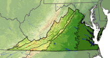
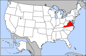
Ing Commonwealth ning Virginia (/vɚˈdʒɪnjə/ ) metung yang American state keng Atlantic Pampang na ning Southern United States. Ing state bantug ya keng lagiung "Old Dominion" neng misan naman bilang "Ima da reng Pamuntuk" ("Mother of Presidents"), pauli ning kebaitan karinan da ring walung U.S. a pamuntuk. Ing state mealkus ya geographically kareng Blue Ridge Mountains ampo ning Chesapeake Bay, karinan da reng keraklan da reng sampanga ampong animales.Ing tungku (kabisera) na ning commonwealth iyapin ing Richmond, Virginia Beach iya ing pekamarakal diling populasiun, at ing Fairfax County iya ing pekamrakal a populasiun a makadekeng pampolitical. Ing populasiun na ning state maiggit yang pitung yuta..[1]


Klima
[mag-edit | alilan ya ing pikuwanan]| Climate chart for Virginia | |||||||||||
|---|---|---|---|---|---|---|---|---|---|---|---|
| J | F | M | A | M | J | J | A | S | O | N | D |
3.1
46
26
|
3.1
48
27
|
3.7
57
34
|
3.3
67
43
|
4
76
52
|
3.7
83
60
|
4.3
86
64
|
4.1
85
63
|
3.5
79
57
|
3.4
69
45
|
3.2
58
35
|
3.2
48
28
|
| average temperatures in °F precipitation totals in inches source: University of Virginia Climatology | |||||||||||
|
Metric conversion
| |||||||||||


| Dake Politiku ning United States | |
|---|---|
| States | Alabama | Alaska | Arizona | Arkansas | California | Colorado | Connecticut | Delaware | Florida | Georgia | Hawaii | Idaho | Illinois | Indiana | Iowa | Kansas | Kentucky | Louisiana | Maine | Maryland | Massachusetts | Michigan | Minnesota | Mississippi | Missouri | Montana | Nebraska | Nevada | New Hampshire | New Jersey | New Mexico | New York | North Carolina | North Dakota | Ohio | Oklahoma | Oregon | Pennsylvania | Rhode Island | South Carolina | South Dakota | Tennessee | Texas | Utah | Vermont | Virginia | Washington | West Virginia | Wisconsin | Wyoming |
| Federal district | District of Columbia |
| Insular areas | American Samoa | Guam | Northern Mariana Islands | Puerto Rico | Virgin Islands |
| COFA | Republic of the Marshall Islands | Republic of Palau | Federated States of Micronesia |
| Minor outlying islands | Baker Island | Howland Island | Jarvis Island | Johnston Atoll | Kingman Reef | Midway Atoll | Navassa Island | Palmyra Atoll | Wake Island |
- ↑ Cite error: Invalid
<ref>tag; no text was provided for refs nameddemographics


